


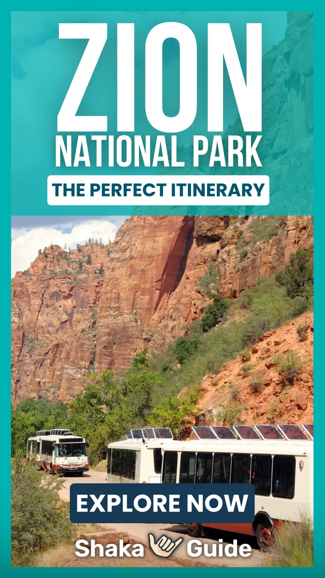
Shaka Guide's Zion National Park Itinerary

- Zion Canyon requires mandatory shuttle access most of the year, so plan parking and arrival times carefully.
- Angel’s Landing and The Subway both require permits, which must be secured through Zion’s official lottery system.
- Start hiking before 7 a.m. to avoid extreme heat, heavy crowds, and long shuttle wait times.
- Kolob Canyons and Kolob Terrace offer scenic drives and quieter hikes without shuttle restrictions.
- Check trail closures and flash flood conditions daily, especially before hiking The Narrows or slot canyons.
Zion National Park is the third most visited in the U.S.—and for good reason. Its mesas, mountains, cliffs, and canyons draw visitors worldwide.
This 50-mile road trip itinerary guides you from La Verkin to East Zion, featuring epic views, major highlights, and hidden gems off the main route.
Along the way, you’ll discover must-see viewpoints, quiet slot canyons, ghost towns, and ancient rock art.
Whether for a weekend getaway or a full adventure, these are the Zion National Park stops you won’t want to miss.
- Important Information
- ZION NATIONAL PARK ITINERARY
- 1. La Verkin Overlook
- 2. Grafton Cemetery
- 3. Grafton Ghost Town
- 4. Zion Canyon Visitor Center
- 5. Pa'Rus Trail
- 6. Zion Human History Museum
- 7. Court of the Patriarchs
- 8. Zion Lodge and Emerald Pools
- 9. The Grotto and Angel's Landing
- 10. Great White Throne, Weeping Rock, and Observation Point
- 11. Temple of Sinawava, Narrows, and Riverside Walk
- 12. Great Arch Viewpoint
- 13. Canyon Overlook Trail
- 14. Many Pools Trailhead
- 15. Checkerboard Mesa
- 16. East Ranger Station
- Optional Side Trips
- • Kanab
- 1. Dinosaur Tracks Trailhead
- 2. Sand Caves
- 3. Peek-a-boo Canyon
- 4. Elkheart Canyon
- 5. Belly of the Dragon
- • Kolob Canyons
- 1. Kolob Canyons Visitor Center
- 2. Taylor Creek Trail
- 3. Timber Creek Trail and Kolob Overlook
- • Kolob Terrace
- 1. The Subway
- 2. Cave Valley Trails
- 3. Firepit Knoll Volcano
- 4. Northgate Peaks Trail
- 5. Lava Point Overlook
- • Kanab
Important Information
Because Zion National Park is so popular, the main Zion Canyon area can get pretty crowded—especially during peak months. To help ease congestion and protect the park’s natural beauty, Zion has operated a mandatory shuttle system since 2000.
Shuttle season runs from February through November, and during this time, personal vehicles are not allowed in Zion Canyon. For details on how the shuttle works, be sure to check out our Know Before You Go and Shuttle Guide articles.
Closures: The Weeping Rock and Observation Point stops remain closed indefinitely due to a major rockslide in 2019. As of 2025, there are no announced plans to reopen those trails.
Permits: Beginning in 2022, a permit lottery is required to hike Angels Landing. You can learn more about how the lottery works here.
A permit is also required to hike The Subway, due to the route’s technical challenges and fragile environment. You can find more information about that here.
Zion National Park Itinerary

Only one day in Zion? This itinerary is packed with iconic hikes, scenic viewpoints, and hidden gems. To see it all, we recommend hitting the road before 7 a.m.
If you have more time, explore our day-trip add-ons for Kanab, Kolob Canyons, and Kolob Terrace—stunning, lesser-visited areas included in your Shaka Guide tour. I’ll provide directions, expectations, and timing as we approach, letting you choose your own adventure.
1. La Verkin Overlook
 Rachel Ennis
- Approximate time: 15 minutes
At La Verkin Overlook, you’ll get a beautiful panoramic view of Zion Canyon, the Virgin River Gorge, Pine Valley mountains, and, of course, La Verkin itself.
To get there, you’ll take a 15-minute round-trip drive down a bumpy gravel road. But hey, sometimes, the journey is half the adventure.
2. Grafton Cemetery
 Rachel Ennis
- Approximate time: 10 minutes
At Grafton Cemetery, you’ll find the resting places of early pioneers alongside members of the local Native American community.

3. Grafton Ghost Town
 Rachel Ennis
- Approximate time: 15 minutes
Grafton is a ghost town with a history that sets it apart.
While most abandoned settlements in the West were mining towns—rising fast and falling just as quickly—Grafton was rooted in agriculture.
Today, visitors can explore the old homes, some still standing strong enough to step inside, and get a feel for what life was like in this once-thriving pioneer community.
4. Zion Canyon Visitor Center
 Rachel Ennis
- Approximate time: 45 minutes
At the Zion Canyon Visitor Center, you can pick up trail maps, browse the bookstore, and refill your water bottles.
If you're planning any backcountry camping or canyoneering, this is also where you'll need to get your Wilderness Permits.
The turnoff is just past the entrance gate—look to your right.
5. Pa'Rus Trail
 John Manard
- Approximate time: 1 hour
Does the shuttle line look a little... daunting? Here’s a pro tip: just skip it.
All you need to do is take the sunny Pa’rus Trail from the Visitor Center to the Human History Museum and hop on the shuttle there—no waiting required.
This is the only trail in Zion where you can walk your dog or ride a bike, and it’s fully paved. That said, it’s 1.7 miles one way, so it’s not ideal for everyone.
Follow the signs at the Visitor Center if this sounds like your kind of detour.
6. Zion Human History Museum
 Don Graham from Redlands, CA, USA
- Approximate time: 30 minutes
Step inside to explore over 300,000 artifacts, specimens, and pieces of art that tell Zion’s story.
Need a break to beat the heat? Catch the free 22-minute film about the park—or better yet, head to the shady back patio for a Ranger talk. These expert-led sessions dive into topics like geology, wildlife, and more, each with its own unique flair.
You might even catch a guided ranger walk or hands-on activity. For the latest schedule, check in at the Visitor Center.
7. Court of the Patriarchs
 au_ears
- Approximate time: 10 minutes
These three striking, white-capped peaks form the Court of the Patriarchs. From left to right, you’ll see Abraham, Isaac, and Jacob—named after the patriarchs of Judaism.
It was Methodist minister Fred Fisher who gave them these names, hoping to reflect the awe and reverence these cliffs inspire.
This is a quick roadside stop, so feel free to hop off, snap a photo, and take in the majesty of the Court up close.
8. Zion Lodge and Emerald Pools
 Rachel Ennis
- Approximate time: 2 hours
Zion Lodge is the only place in the park where you can grab something to eat, and the shady cottonwood tree makes this the perfect picnic stop.
Not hungry? You can also stop here to use the restroom and refill your water bottles before heading out.
Zion Lodge is also the most commonly used entrance to the Emerald Pools Trail--an extremely popular trail that's family-friendly. If you’re lucky and the conditions are just right, you may be treated to sparkling, emerald-green water beneath the twinkling hanging gardens.
If you only hike to the Lower Pool, you’ll follow a short, paved path about a half mile long starting from the Zion Lodge. If you prefer a longer, unpaved trail, enter at The Grotto, one stop down the road. Round-trip distances are:
- 1.2 miles to lower,
- 2 miles to the middle and
- a whopping 3 miles to the upper pools
9. The Grotto and Angel's Landing
 Nicolas Vollmer from Munich [Allemagne]
- Approximate time: 4 hours
Thinking of hiking Angel’s Landing? You’re not alone. I mean, really not alone.
In fact, so many people wanted to hike Angel's Landing that starting in 2022, the National Park Service began requiring a permit, handed out via lottery.
Yep—you now need to win the right to terrify yourself.
Check the Zion National Park website for the latest details.
Now, let’s talk trail.
At its most infamous point, the path narrows to just a few feet, with sheer drop-offs on either side. Chains are bolted into the cliff to hang onto—so if your palms are already sweating, no shame in stopping short.
Good news, though:
The trail up to Scout Lookout doesn’t require a permit. And while you'll still need to conquer Walter’s Wiggles—a series of 21 tight, relentless switchbacks with an aggressively cheerful name—the rest of the trail is paved and very doable with a bit of stamina.
Scout Lookout offers a killer view of Angel’s Landing without the death-defying finale. It’s a win-win for folks who like their hikes with a side of oxygen and dignity.
You’ll find the Angel’s Landing trailhead just past the Grotto Bridge. Refill your water bottles at the shuttle stop—hydrated hikers are happy hikers.
10. Great White Throne, Weeping Rock, and Observation Point
 John Dahlstet
- Approximate time: 4 hours
Around 800 A.D., by rain and snow, water began working its way through the layers of what we now call “Weeping Rock.”And for over 1,000 years, that water percolated downward before encountering the impermeable Kayenta Formation.
Forced to move horizontally, the water diffused out of the soft limestone, washing away the formation as it went, and creating the alcove known as Weeping Rock.
There are also two very popular but very challenging hikes here.
1. Observation Point
Craving a view that makes Angel’s Landing look downright average? Head for Observation Point—the highest easily accessible viewpoint in Zion Canyon.
It's a strenuous 8-mile round trip via the East Mesa Trail, with serious elevation gain. Translation: this hike isn’t messing around. If you’re up for the challenge, follow the East Mesa Trail until it splits toward Observation Point. There, you can claim your reward... sweeping, panoramic views—and, of course, bragging rights.
2. Hidden Canyon Trail
Shorter, but no less dramatic. Hidden Canyon is just over 2 miles round trip, but don’t let that fool you. It’s steep, exposed, and not for anyone with a fear of heights.
Along the way, you’ll be treated to dizzying vistas, a free-standing arch, and a tucked-away slot canyon that feels like Zion’s best-kept secret.
Give yourself extra time—it’s slow going in spots, especially if your legs start questioning your life choices.
Note: As of 2019, this stop is closed due to a rockfall. No re-opening date is released as of this writing in 2025.
11. Temple of Sinawava, Narrows, and Riverside Walk
 Rachel Ennis
- Approximate time: 2-4 hours
This stop marks the start of several great hikes, including one of Zion’s most iconic—The Narrows. In places, the canyon walls squeeze in to just 9 meters (30 feet) apart.
It’s my personal favorite hike in the park, hands down. And if you're hot-natured like me, wading through cool canyon water might just make it your favorite too.
The water can get as high as your thighs, so come prepared! There’s no official endpoint—just hike upstream as far as you’d like, then turn around when you’re ready.
The bottom-up hike from the Temple of Sinawava does not require a wilderness permit and is a fun, cooling trip through the slot canyon up the Virgin River. Just be sure not to go past Big Springs unless you have a permit. It’s about three miles to “Wall Street,”-the section of the canyon where the walls begin to narrow.
But, let's say you don't have time for The Narrows...or, maybe, you just don't want to get wet. Understandable. Just turn around after completing the highly recommended Riverside Walk.
This two-mile paved and accessible trail is appropriate for visitors of all fitness levels. As you walk along the hanging gardens, be on the lookout for Zion Snails. These tiny, pinhead-sized black snails can only be found along the weeping walls here and nowhere else in the world! See if you can spot them!
One last note: the river water is not considered potable due to the presence of cyanobacteria. So, before heading in, be sure to fill up your water bottle and use the restroom.
12. Great Arch Viewpoint
 James St. John
- Approximate time: 10 minutes
When an arch is not freestanding, it's called a “blind arch.” Zion's blind arch can be seen along the roadway or at several pullovers along its serpentine road. Just safely swing in and snap those pictures.
13. Canyon Overlook Trail
 Rachel Ennis
- Approximate time: 1 hour
This 1-mile hike comes highly recommended—by just about everyone. And especially by me. It leads to a stunning viewpoint overlooking the rugged beauty of East Zion.
The trail is moderate in difficulty, but expect a bit of adventure: you’ll cross slickrock and pass near some steep drop-offs. Despite the name, slickrock isn’t actually slippery—unless it’s wet from rain or snow.
If you want to check out Canyon Overlook Trail, after the tunnel, just pull into the first turnouts. If they’re full, then just continue driving until another pull-off, then walk back to the trailhead.
14. Many Pools Trail
Ready for a little hike? If so, you might be interested in the “Many Pools Trail.”If you’re here at the right time, after it rains or in early spring, the potholes worn into the stone will be filled with water, filling the area with multiple reflective pools. It’s short and moderately difficult—only a little over 2 miles roundtrip.
15. Checkerboard Mesa
 Rachel Ennis
- Approximate time: 10 minutes
Best viewed from a distance, the white sandstone bears criss-crossed or “checkerboard” bands on its face.
While the Checkerboard Mesa Canyon trail begins a little further westward, the best viewpoint is a little further east, towards the far-end of the park, just past the mesa.
16. East Ranger Station
 Clayton B. Fraser
- Approximate time: 5 minutes
Interested in exploring even more of East Zion? At the Ranger station, you’ll have access to several famous hiking trails, including Observation Point, the highest lookout in Zion.
Since the rockslide has currently closed the route via East Mesa, as of 2025, this is the only way to reach Observation Point.
If you're interested in history, the East Rim Trail offers views of the remnants of the Cable Mountain Draw Works, an early 1900s pulley system once used to lower timber into the canyon.
These trails are long, rugged, and interconnected, so be sure to check trail conditions, maps, and current access with a ranger before heading out.
Optional Side Trips
Have time for a multi-day adventure away from the crowds? As you drive, your Shaka Guide narrator will point out optional side trips, providing directions and timing for each.
If you're after the full Zion experience—from iconic highlights to hidden gems—we'll be with you every step of the way.
This includes the less-traveled Kolob Canyons and Kolob Terrace, two stunning sections that many visitors miss. Check the details below to start planning your detours.
Kanab
 P199, CC BY-SA 3.0, via Wikimedia Commons
For explorers starting their tour from the eastern side of the park, they'll have the opportunity to first check out the town of Kanab.
Kanab has a lot to see and do: From its rich Western film history at the Little Hollywood Museum to the Best Friends Animal Sanctuary, to the stunning red rock landscapes of the nearby Coral Pink Sand Dunes State Park, Kanab offers a perfect blend of culture and nature.
Visitors can explore the charming downtown area, filled with local art galleries and unique shops, or embark on guided tours to nearby slot canyons and ancient petroglyphs.
Here are some of the recommendations you'll find on your tour.
1. Dinosaur Tracks Trailhead
- Approximate Time: 1 hour
Up first is a short scramble and hike to some ancient dinosaur tracks! Scientists think the animal that lest these was a Grallator—a three-toed, carnivorous dinosaur that looked like a raptor.
2. Sand Caves
 Flickr User respres, CC BY-SA 2.0, via Wikimedia Commons
- Approximate Time: 1 hour
These Sand Caves, or Moqui Caves, aren’t natural formations—they’re actually man-made remnants of a short-lived sand mining operation that was here in the 1970s.
3. Peek-a-boo Canyon
- Approximate Time: 10 hours
Utah's desert harbors many slot canyons and narrow passages carved by water erosion in sandstone. Peek-a-boo Canyon, accessible via a short sandy hike, is a prime example.
It features the Moqui Steps, believed to have been carved by Ancestral Puebloans over a millennium ago.
While visitors can't climb these ancient stairs, they remain a fascinating historical sight.
4. Elkheart Canyon
 Image from Flickr by The Greater Southwestern Exploration Company
- Approximate Time: 10 hours
The canyon was formed by the same forces that sculpt many slot canyons—water erosion. Over time, water flowed through the sandstone, slowly carving away at the rock, creating the narrow walls and dramatic formations you see today.
5. Belly of the Dragon
- Approximate Time: 1 hour
This man-made tunnel was originally constructed as a water culvert, but over time, the relentless water flow sculpted the sandstone walls and created a dramatic, ribcage-like appearance. That, combined with the tunnel's length and darkness, lends it the name "Belly of the Dragon." This stop is incredibly popular for its epic photo opportunities.
Kolob Canyons
 by Paul - Briden from Getty Images
Tucked just off I-15, the entrance to Kolob Canyons is about 20 minutes north of La Verkin or 15 minutes south of Cedar City—easy to reach, but often blissfully overlooked.
This section offers a 15-minute scenic drive that’s short, sweet, and ridiculously stunning. Plus, you’ll find several trails that don’t come with shuttle lines or crowds. Imagine that.
Driving south from Cedar City without a park pass? No problem—stop at the Kolob Canyons Visitor Center and grab one. It’s quick, painless, and ranger-approved.
Heads-up: If it snows, Kolob Canyons may close. Nature has the final say out here.
1. Kolob Canyons Visitor Center
 Rachel Ennis
- Approximate time: 20 minutes
As you pull in, be sure to check in at the Kolob Canyons Visitor Center to show your park pass.
2. Taylor Creek Trail
 Image from Flickr by Jack Miller
- Approximate time: 3 hours
The first trail you’ll pass will be Taylor Creek Trail, a 5-mile round-trip hike with several unique sights. The Fife and Larson cabins—the first homes built in Kolob Canyons—can be found here, as well as a double arch.
For those of you who love history, follow the trail to the end to find the waterfall used by Mountain Meadows Massacre perpetrator John D. Lee during his hideout from the law.
As you pass the Taylor Creek Trailhead, cast your eyes ahead and slightly to the left. You’ll see a summit towering over three small finger canyons. That towering summit is Horse Ranch Mountain—the highest peak within the park’s boundaries.
The three finger canyons—Tucupit, Paria, and Beatty points, from left to right—are stunning. You'll definitely want to use one of the pull-offs to stop and appreciate them further.
3. Timber Creek Trail and Kolob Overlook
 Rachel Ennis
- Approximate time: 1 hour
The Timber Creek Trail marks the end of the road here in Kolob Canyon, and it’s a highly recommended stop. It’s only a one-mile round-trip hike, and even though it's an uphill walk on the way to the overlook, it’s all downhill from there!
When you reach the top, look east to Shuntavi Butte at the base of Timber Top Mountain.
Kolob Terrace
 by Jim Cook from Getty Images
From La Verkin, take UT-9 East to the town of Virgin. Just past Virgin, you’ll see the sign for Kolob Terrace Road on your left.
Even if you skip the hikes, the scenic drive alone takes about 45 minutes each way—perfect for soaking in the views without ever leaving your car.
Heads up: like Kolob Canyons, Kolob Terrace may close during snow events, so check conditions before you go.
1. The Subway
 John Fowler from Placitas, NM, USA, CC BY 2.0
- Approximate time: 4 hours
One of the first sights you’ll pass is The Subway, one of Zion’s most popular—and visually stunning—canyoneering spots.
To hike The Subway, you’ll need a Wilderness Permit obtained through Zion’s lottery system. No permit, no entry—so make sure you have your ticket.
There are two ways to experience The Subway: bottom-up or top-down.
The bottom-up route is less technical, requires no canyoneering skills, and starts at the Left Fork trailhead, which you’ll find on your right.
As you pass the Subway entrance at Left Fork Creek, look ahead to spot the Tabernacle Dome. This large, rounded white mesa may remind you of the Tabernacle Dome in Salt Lake City, for which it was named.
2. Cave Valley Trails
- Approximate time: 2 hours
Located just off a short trail—about a mile each way—are two intriguing archaeological sites in Cave Valley.
The first leads to a cave adorned with ancient pictographs. The second ends at an altar made of animal bones.
These sites are still under study, and much remains unknown about who created them, when, or why. Because of their delicate nature, it’s crucial to respect these sites fully—do not touch anything, as even the oils from our hands can damage the fragile pictographs.
These trails are less traveled and can be hard to find.
For more information and detailed directions, be sure to check out our hiking guide or speak to a park ranger.
3. Firepit Knoll Volcano and Hop Valley Trailhead
- Approximate time: 5-30 minutes
An optional side-trip, the Hop Valley Trail is pretty lengthy in its entiretly, but following it just 15 minutes will take you to multiple rock spires known as hoodoos.
As you pass the Hop Valley Trailhead, take a look to your left and try to pick out the large, cone-shaped mountain.
What you see there is a volcanic cinder cone, leftover from an eruption occurring sometime around 300,000 years ago.
There are several cinder cones along Kolob Terrace—see if you can spot them as you continue winding your way to the summit.
4. Northgate Peaks Trail
 By Efenzi from Getty Images Signature
- Approximate time: 3 hours
This four-mile round-trip hike beginning at Wildcat Canyon takes us to the Northgate Peaks.
Emerge from the ponderosa forest between the two Slickrock peaks, looking out at the valley far below and the North Guardian Angel to the South.
5. Lava Point Overlook
 Rachel Ennis
- Approximate time: 15 minutes
And finally, the best for last. Lava Point Overlook is a basalt cliff that overlooks a green volcanic valley filled with pinyon, juniper, and white pine trees.
From the over 2,400-meter-high overlook, you can see all the way out to the Paunsaugunt Plateau of Bryce and even the North Rim of the Grand Canyon.
Explore Zion with Shaka Guide
From the depths of Zion Canyon, to the top of Kolob Terrace, there's no shortage of wonders to behold in Zion National Park.
Be sure not to miss a thing by traveling with Shaka Guide. Our comprehensive audio tour takes you from A to Zion, with all the need-to-know stops and stories shared along the way.

Rachel Ennis is a storyteller, nature nerd, and park enthusiast who believes every trail has a tale. Zion was her first love—the very first tour she wrote for Shaka Guide—and the moment she saw those towering red walls, something clicked.
That spark of awe has followed her to every park since. Now, she’s on a mission to share the stories that live in the land and the spaces that make us feel small in the best way.
Ready to explore Zion?
Take Shaka Guide’s Zion National Park Audio Tour for turn-by-turn directions, local stories, and the freedom to explore at your own pace.
Visiting more parks in the region?
Don’t miss our Utah Mighty 5 Tour Bundle — it includes tours for Arches, Canyonlands, Bryce Canyon, and many more!
Still planning?
Check out our Zion National Park Itinerary and Know Before You Go guide to prep for your trip.
Have questions?
We’re happy to help — email us at aloha@shakaguide.com.
Like this article? Share it on Pinterest!
RELATED ARTICLES:
The Ultimate Zion National Park Travel Guide
When is the Best Time to Visit Zion National Park?
Zion to Grand Canyon North Rim - What You Need To Know
Zion National Park Shuttle - What You Need To Know
37 Hikes in Zion National Park- Zion Hiking Guide
Airports Near Zion National Park


 to fuel your ride
