


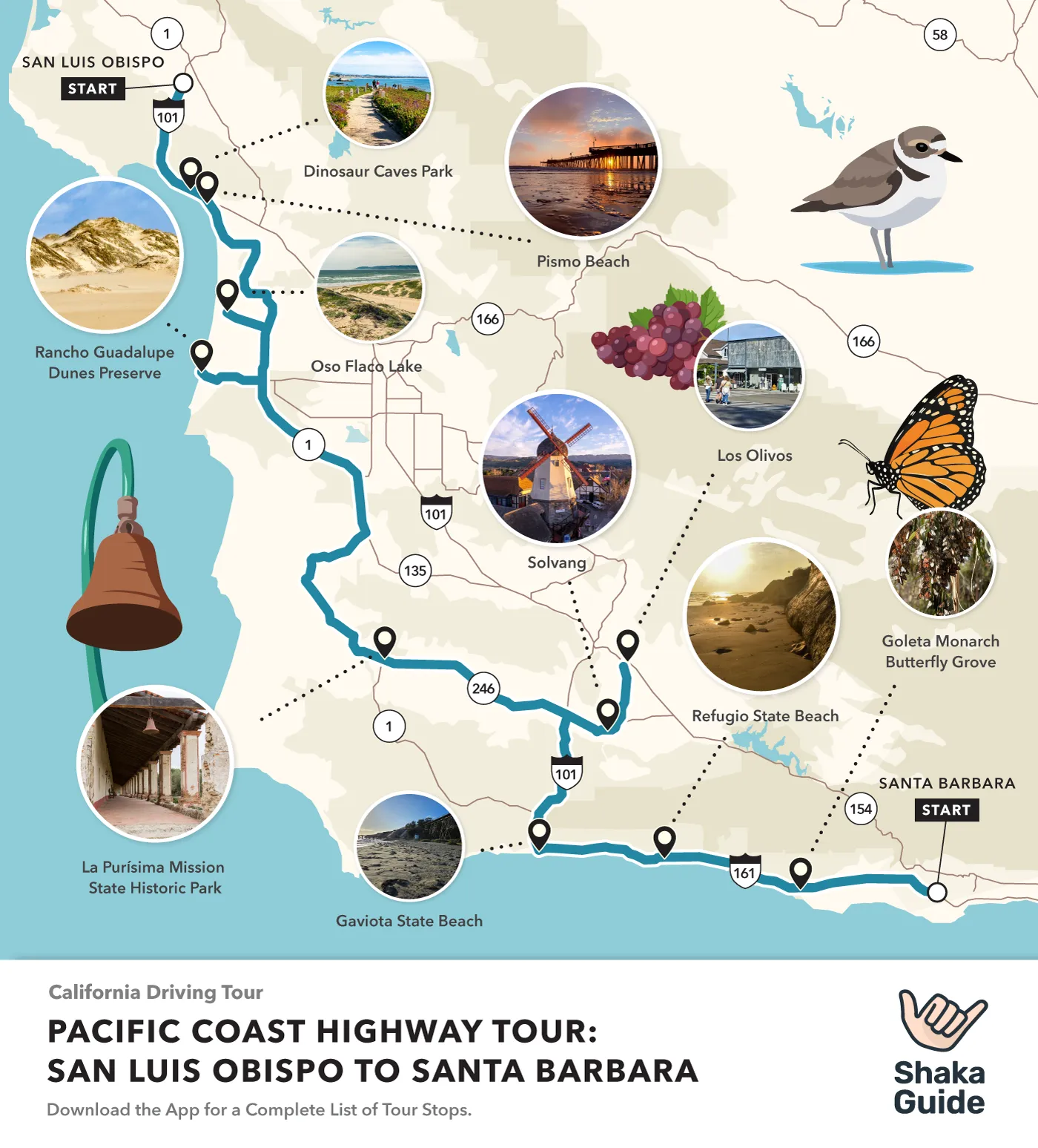
Shaka Guide's Pacific Coast Highway: San Luis Obispo to Santa Barbara Itinerary

Shaka Guide continues its journey on the Pacific Coast Highway.
This tour is one of four Shaka Guide tours that explore the Pacific Coast Highway between San Francisco and Los Angeles.
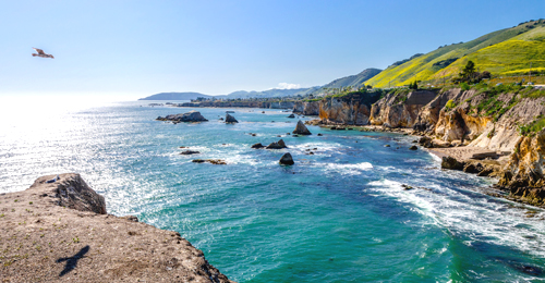
This tour stretches between San Luis Obispo and Santa Barbara, passing through the Pismo Beach area and Santa Barbara Wine Country.
Join us as we explore gorgeous beaches, popular towns, and California's colonial history along the El Camino Real, or "The Royal Road."
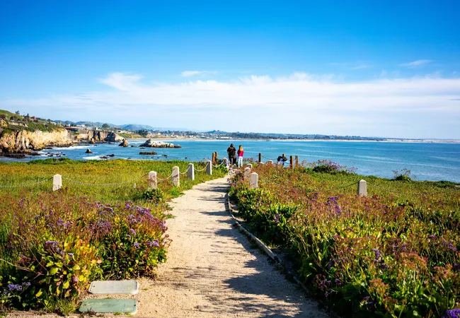
There are 15 stops on this tour, which works going in either direction. If you're heading south, the tour ends as you enter Santa Barbara, known as the American Riviera.
- Dinosaur Caves Park
- Pismo Beach
- Pismo State Beach Butterfly Grove
- Oso Flaco Lake
- Guadalupe-Nipomo Dunes Center
- Rancho Guadalupe Dunes Preserve
- La Purisima Mission State Historic Park
- Los Olivos
- Mission Santa Inés
- Solvang
- Ostrichland USA
- Gaviota State Beach
- Refugio State Beach
- El Capitán State Beach
- Goleta Monarch Butterfly Grove
The following itinerary starts in San Luis Obispo and heads southeast, towards Santa Barbara. Many beaches require a fee to park.
However, state beaches share the same fee. If you park at one, you can display your parking pass on the dashboard for the others.
If you're planning on stopping at more than one, then buying a day pass at the first state beach you visit is a good idea.
Itinerary
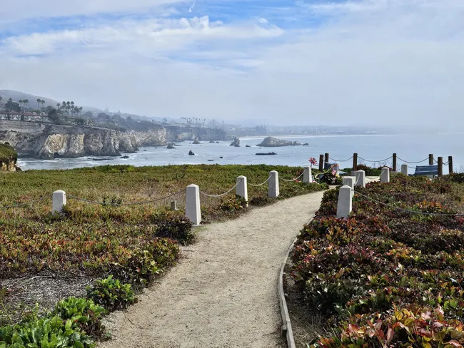
1. Dinosaur Caves Park
 Matt Caracciolo
- Duration: 30 minutes
This charming park is located on land that used to be a roadside attraction, featuring an incomplete concrete dinosaur and a sea cave.
The dinosaur is gone, and the sea cave collapsed, but in its place is an imaginative playground, easy walking paths, and stellar views of the coastal cliffs and sea stacks.
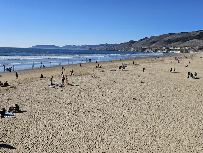
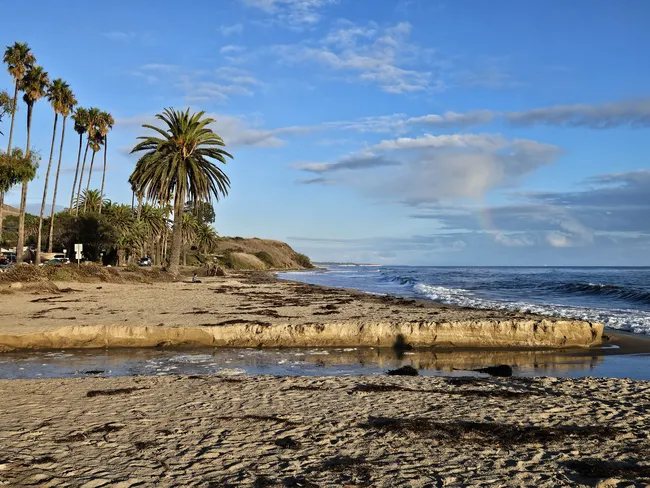
2. Pismo Beach
 Matt Caracciolo
- Duration:1 hour
Billed as "The Clam Capital of the World," the town of Pismo Beach is a popular beach town, known for its classic feel, pier, wide sandy beach, and, of course, Pismo clams. There are plenty of shops and restaurants to keep you busy as well.
3. Pismo State Beach Butterfly Grove
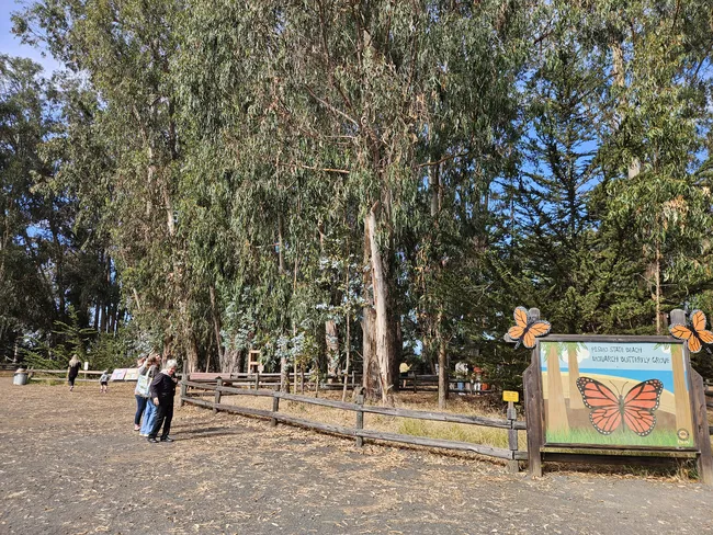 Matt Caracciolo
- Duration: 15-30 minutes
There's not much to see in this stand of trees for much of the year, but from late October to February, monarch butterflies use this tree grove as a wintering spot, sometimes coming in the thousands. The grove is just a few steps from Highway 1, and the path is quick and easy.
4. Oso Flaco Lake
 Matt Caracciolo
- Duration: 30-60 minutes
Oso Flaco Lake is another access point to the Guadalupe Nipomo Sand Dunes. From the parking lot, you'll walk past the 75-acre Oso Flaco Lake, which is great for birding and wildlife viewing.
It's a 2-mile round-trip hike to the beach access, where you'll get another great view of the dunes. The hike is easy and mostly flat or on boardwalks.
5. Guadalupe-Nipomo Dunes Center
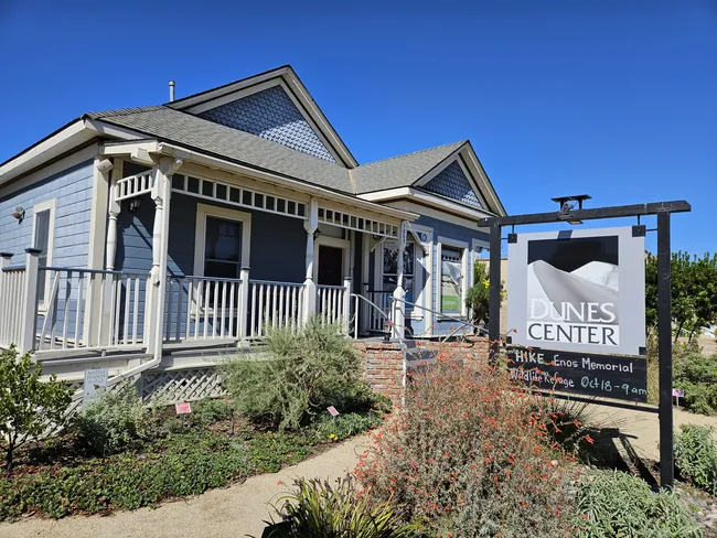 Matt Caracciolo
- Duration: 30 minutes
This small museum is located in an old house within the town of Guadalupe. Learn about the lost movie set for Cecil B. DeMille's original The Ten Commandments, which was filmed on location in the Rancho Guadalupe Dunes Preserve. The museum houses artifacts and pieces from the Ancient Egyptian set.
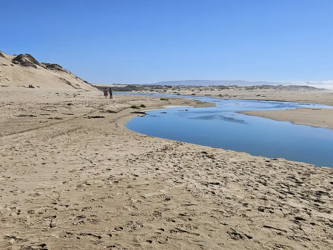
6. Rancho Guadalupe Dunes Preserve
 Matt Caracciolo
- Duration: 30-60 minutes
This park preserves one of the most epic and pristine portions of the Guadalupe-Nipomo Sand Dunes complex.
Massive sand dunes hundreds of feet high sit near the ocean, creating a windy, dramatic, otherworldly landscape.
If you're up for a 2-mile walk through the sand, you can hike to Mussel Rock for an even better vantage point.
7. La Purisima Mission State Historic Park
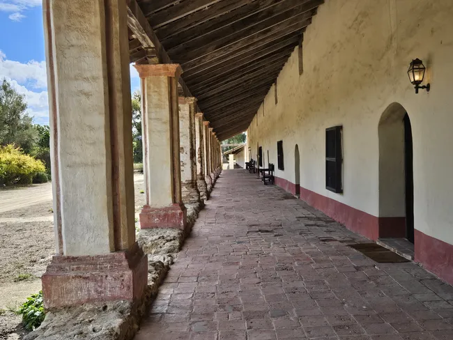 Matt Caracciolo
- Duration: 1 hour
La Purisima is one of the largest and best-preserved of the old Spanish missions in California. It's protected as a state park and features several buildings, gardens, and pastureland.
The visitor center and museum provide context for what was once a busy and important center of mission government.
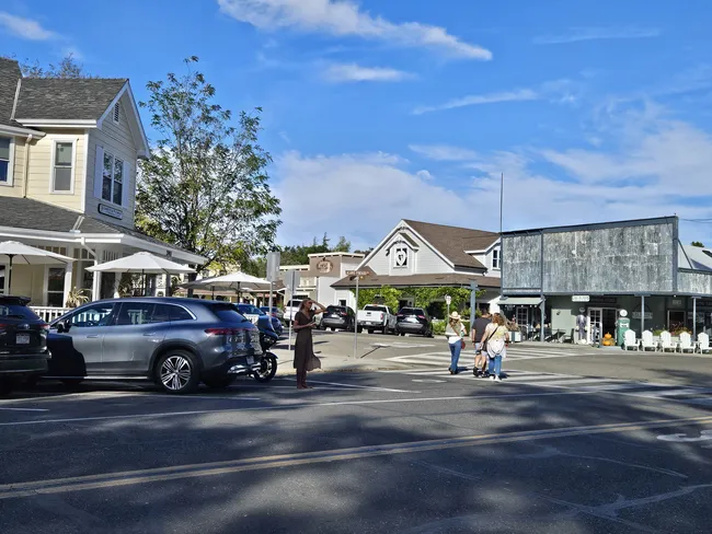
8. Los Olivos
 Matt Caracciolo
- Duration: 1 hour
The small town of Los Olivos is well known as a center of activity in Santa Barbara Wine Country. Tasting rooms, restaurants, and boutiques line the main intersection.

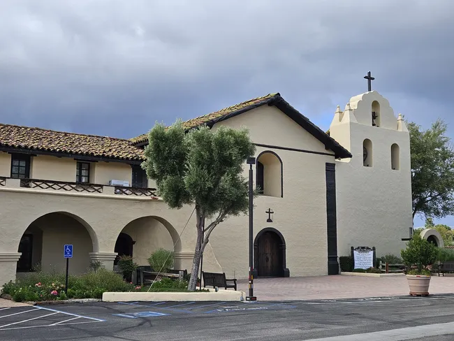
9. Mission Santa Inés
 Matt Caracciolo
- Duration: 30 minutes
Founded in 1804, Mission Santa Inés is a small but well-preserved mission on the outskirts of Solvang. Self-guided tours allow you to access the museum, as well as much of the mission's interior and the gardens.
Outside, a small patch of grapes is believed to be the descendants of the very first wine grapes grown in California.
10. Solvang
 Matt Caracciolo
- Duration: 1-2 hours
Founded in 1911 by Danish Americans, Solvang bills itself as the Danish Capital of America. The town's buildings--full of charming restaurants, bakeries, and shops--are constructed to resemble traditional Danish architecture.
Look for windmills, pastries, and the Hans Christian Andersen museum. Solvang is also part of Santa Barbara Wine Country, so there are some wine tasting rooms mixed in with the Danish vibes.
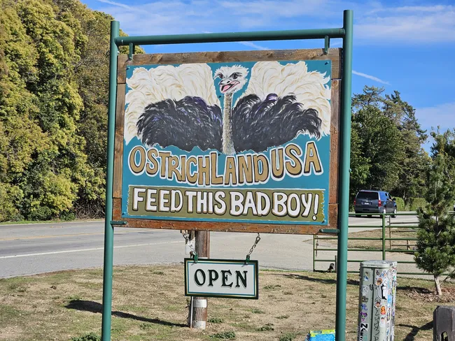
11. Ostrichland USA
 Matt Caracciolo
- Duration: 45 minutes
Over 150 ostriches and emus call this ranch and zoo home. What began as a roadside stand selling ostrich eggs has expanded into a staple of the Santa Ynez Valley.
Visitors can explore the 32-acre ranch, feed the birds, visit the gift shop, and still purchase ostrich eggs.
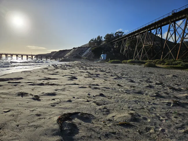
12. Gaviota State Beach
 Matt Caracciolo
- Duration: 30 minutes
Gaviota Beach is uniquely framed by a railroad bridge behind it. And to the right is an old bird-covered pier.
Enjoy the birdwatching and photography opportunities at the most unique of the three beach stops on our tour near Santa Barbara.
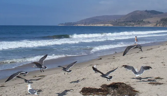
13. Refugio State Beach
 Matt Caracciolo
- Duration: 30 minutes
Two Scottish brothers purchased this land in the early 20th century and made it a camping resort, with imported palm trees giving it an extra tropical feel.
The resort is gone, but the tropical trees and the campgrounds are still there. Enjoy the serenity of this beautiful beach and the swaying palms behind.
14. El Capitán State Beach
 Konrad Summers
- Duration: 30 minutes
This quiet beach is backed by a cliff and framed by the Santa Ynez Mountains beyond. To the left, a trail leads to pleasant picnic sites right along the coast. To the right, walk the beach's sand along the ever-higher coastal cliffs.
A camp store is located up by the parking lot, and restrooms are located in the parking lot as well as next to the beach.
15. Goleta Monarch Butterfly Grove
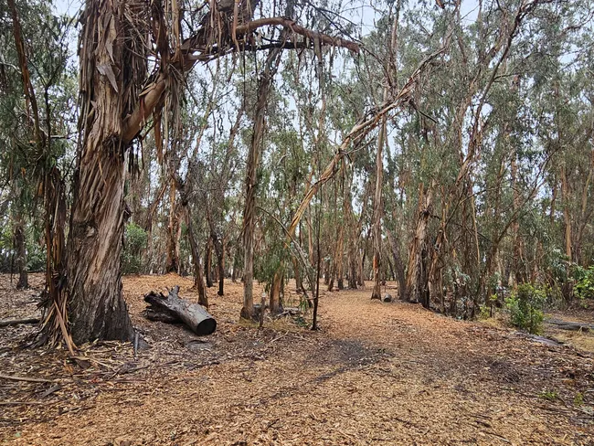 Matt Caracciolo
- Duration: 1 hour
This walk through Ellwood Mesa's eucalyptus trees is pleasant any time of year. From late October to February, migrating monarch butterflies make it an even more magical experience. It's about a mile round trip to the butterfly grove. The trail is easy, and signs point the way to the grove.
Conclusion
Our tour tries to keep things breezy, with enough stops to fill a full day, or recommendations to make it a quicker leg of a much longer journey along the Pacific Coast Highway.
Unlike most of the highway, large portions of this stretch are not actually on the coast, so we enjoy our time inland, immersed in wine country and the unique, Danish-themed town of Solvang.
However you decide to tackle this part of PCH, Shaka Guide will take you where you want to go, and keep you well-informed along the way. You're going to see and learn a lot!

Matt Caracciolo is a travel writer based in Ohio and author of the Shaka Guide tour for Yosemite. Born and raised in Columbus, Matt fell into travel writing while teaching English abroad in South Korea.
He has written two travel books, including the Moon Ohio guidebook, and enjoys writing and editing tours for Shaka Guide. Matt follows Mark Twain’s belief that “travel is fatal,” embracing travel as a way to learn more about the world and ourselves.
Ready to explore the Pacific Coast Highway?
Take Shaka Guide’s PCH: San Luis Obispo to Santa Barbara Audio Tour for turn-by-turn directions, local stories, and the freedom to explore at your own pace.
Visiting more parks in the region?
Don’t miss our California Tour Bundle — it includes tours for Yosemite, Lake Tahoe, Death Valley, and many more!
Still planning?
Check out our Know Before You Go guide to prep for your trip.
Have questions?
We’re happy to help — email us at aloha@shakaguide.com.
Like this article? Share it on Pinterest!


 to fuel your ride
