


Top Scenic Drives in Sedona: Best Routes & Viewpoints

- Plan at least 7–14 days to see California’s national parks comfortably, with longer trips allowing fewer rushed travel days.
- Visit mountain parks in summer and desert parks in winter; September and October offer the best all-around access.
- Start in San Francisco for a central route covering Redwood, Yosemite, Sequoia, Kings Canyon, and Lassen Volcanic.
- Buy an America the Beautiful annual pass to save money if visiting three or more national parks.
- Book lodging and required permits early, especially for Yosemite, Channel Islands ferries, and peak summer travel.
TABLE OF CONTENTS
- Top 3 Sedona Scenic Drives
- Guided Scenic Drives: Pink Jeep & Tours
- Planning Your Trip: Lodging, Permits & Timing
- Recap & Route Recommendation Table
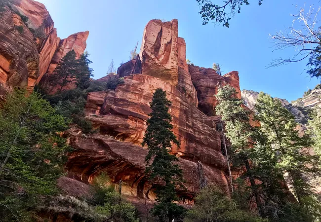
There is nothing like the red rocks of Sedona. The iconic desert landscape surrounds the town, and spreads across rock formations, canyons, and forests.
While some of this scenery is accessible right from the middle of town, the best way to see the sights is with a drive.
I’ll share three of my favorite scenic drives around Sedona. The area is popular, and many of the stops on these drives can fill up quickly.
It’s best to visit during a weekday, or during a shoulder season. Summers are hot, but you’ll find far fewer people on the trails, and discounts at local hotels.
Overview of the Top 3 Sedona Scenic Drives
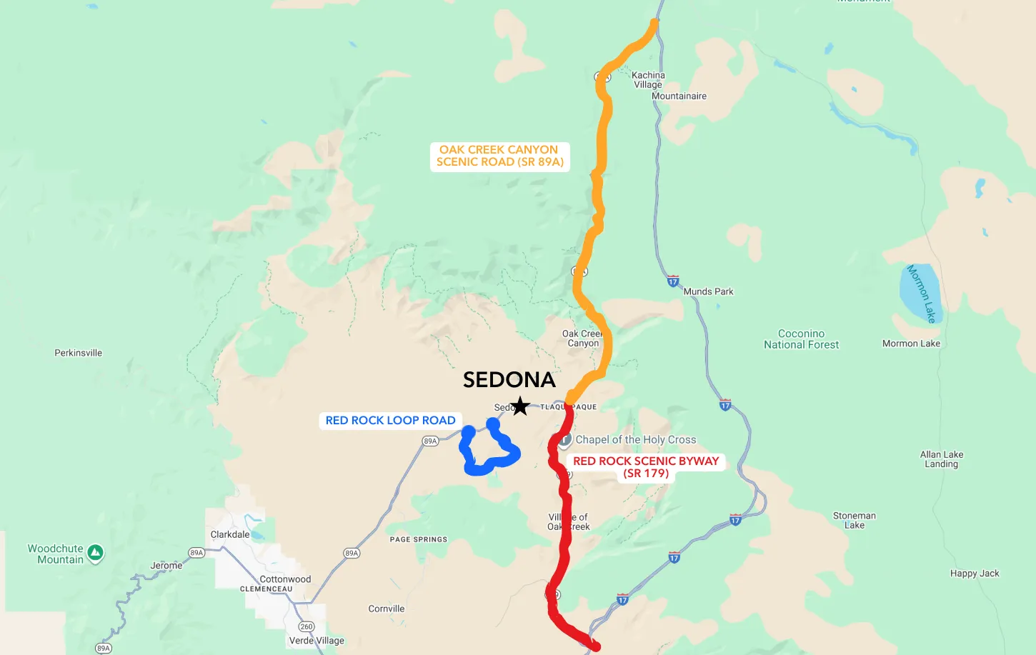
1. Red Rock Scenic Byway (SR 179)
South of Sedona is the Red Rock Scenic Byway. The byway is the 7.5-mile stretch of SR 179 that connects the I-17 interstate with Sedona.
Some of Sedona’s most famous sights are located along this road.
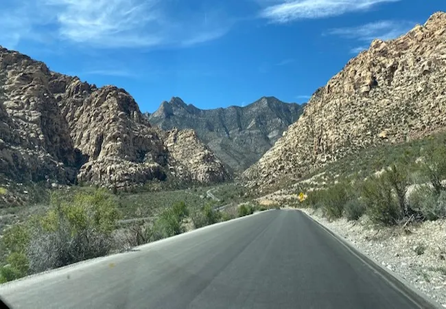
2. Oak Creek Canyon Scenic Road (SR 89A)
 Md Esharuzzman Emu
North of town is Oak Creek Canyon. This road connects Sedona with the city of Flagstaff, about 40 minutes north of the city.
The 16-mile scenic highway twists and curves through Oak Creek Canyon, with red rocks and forests aplenty.
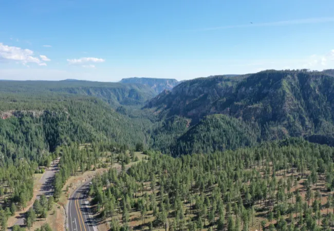
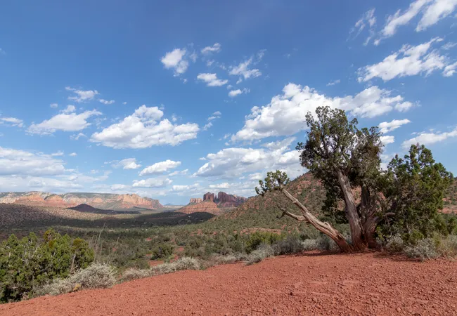
3. Red Rock Loop Road
 Anne02
West of Sedona is Red Rock Loop Road. Just about 8 miles long, the road weaves through some small neighborhoods while also passing vast desert landscapes and excellent views of Sedona’s red rock formations.
Red Rock Scenic Byway (SR 179) Guide
1. Route Details & Map Overview
The 7.5-mile route connects Sedona with I-17. Either direction provides fantastic views, though arriving from the south and heading north may be a tad more impressive.
2. Red Rock Ranger District Visitor Center
Get your bearings at this visitor center for Coconino National Forest. Fill up your water bottle, grab a map, look at the exhibits, and get your first look of the red rocks at a scenic overlook.
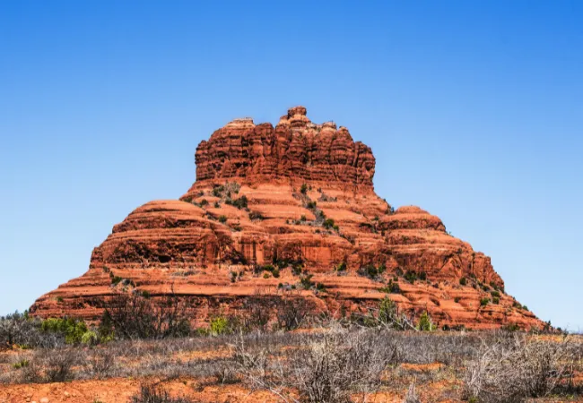
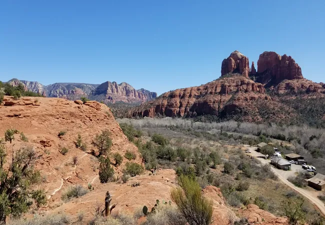
3. Bell Rock & Courthouse Butte
 Malcolm Garret
Two astounding rock formations, Bell Rock and Courthouse Butte, stand right next to each other just south of Sedona. You can hike a loop around them or head straight up Bell Rock.
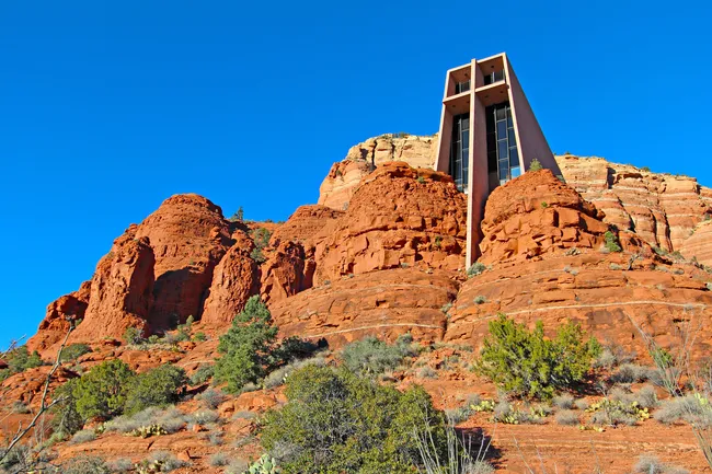
4. Chapel of the Holy Cross
 Shutterstock Image
One of Sedona’s most evocative buildings is this mid-century modern church built atop and into a cliff. Inside, a glass wall captures the desert landscape beyond.
And just outside the entrance, a scenic overlook captures the same view.
5. Tlaquepaque Arts & Shopping Village
 Chris Putnam
This unique shopping mall is meant to evoke a traditional Mexican village, with shops, restaurants, and art galleries.
6. Airport Mesa
 Matthew Caracciolo
The scenic byway ends as you enter Sedona, but take it just a couple of miles further and make the short drive up to the top of Airport Mesa.
The scenic overlook at the top has one of the best views in all of Sedona.
Tips: Parking, Fees & Best View Times
This is the busiest of Sedona’s scenic byways, as it’s the way people enter from Phoenix. Traffic can slow to a crawl during busy times, so plan accordingly.
Parking lots are small and often fill early. The earlier you go, the better. You’ll also need to purchase the Red Rock pass to park by Courthouse Butte and Bell Rock.
You can buy these at kiosks in the parking lots themselves, and come in daily, weekly, or annual options.

Oak Creek Canyon Scenic Road (SR 89A) Guide
1. Route Introduction & Scenic Character
State Route 89A through Oak Creek Canyon is the way to travel between Sedona and Flagstaff.
If you’re traveling between Sedona and the Grand Canyon, you will also likely use this road. And that’s great news, because it’s one of Arizona’s most scenic drives.
From town heading north, the drive starts among the red rock cliffs that are synonymous with Sedona.
The higher you climb, the more the character changes with the elevation, as red rocks give way to forests.
The grand finale, after a series of switchbacks, is a fantastic vista up at the top of the canyon.
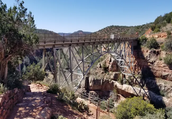
2. Midgley Bridge Pull‑Off
 Matthew Caracciolo
Midgley Bridge is located just a couple of minutes away from Sedona and is surrounded by the iconic red rocks.
There’s not much to do here, but the bridge is a scenic place to take some photos.
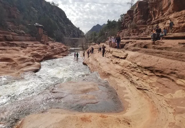
3. Slide Rock State Park
 Matthew Caracciolo
One of the area’s best state parks, Slide Rock, is located on an old homestead. Walk through an old apple orchard to reach the park’s namesake: a natural water play area with slides carved into the rock.
4. West Fork Trailhead
 Matthew Caracciolo
Another highlight is the hike into the West Fork of Oak Creek Canyon. The trail meanders into the forested branch of the canyon, keeping you entirely surrounded by towering cliffs.
It’s 6.5 miles round trip, considered moderately difficult, and requires a few creek crossings, but it’s well worth the effort.
5. Oak Creek Vista Overlook
 Matthew Caracciolo
After driving a series of switchbacks, your reward at the top is an incredible scenic viewpoint looking down over the canyon you just drove through.
A Native American craft market sets up camp daily on the path between the viewpoint and the parking lot.
Amenities & Visitor Safety Tips
Midgley Bridge requires the Red Rock Pass. If you already have one from visiting the Red Rock Scenic Byway that day, then you’re all set.
Slide Rock State Park and West Fork Trailhead both charge their own fees. Oak Creek Vista is free to visit.
Red Rock Loop Road
1. Lover’s Knoll
 Matthew Caracciolo
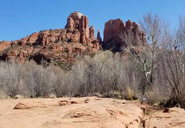
This little pullover is unmarked, but it’s a great place to get out of the car and take some sunset photographs of the stunning red rock scenery, including Sedona’s most famous formation: Cathedral Rock.
2. Secret Slickrock Trail View
 Adam Kampe
Our favorite way to see Cathedral Rock is from this off-the-beaten-path trail. It’s under a mile round trip, easy, and takes you to a wide open ledge with Cathedral Rock standing right across.
3. Crescent Moon Picnic Area
 Matthew Caracciolo
A more popular place to get that perfect shot of Cathedral Rock is at this picnic area. People try to get a picture of the rock reflected in Oak Creek, which meanders along the park.
4. Red Rock State Park
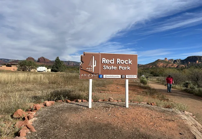 Adam Kampe
Red Rock State Park offers several hiking trails ranging from easy to challenging. Some immerse you in the desert scrub, where you can keep your eyes peeled for wildlife. Others take you to more open vistas.
5. Tips: Parking, Fees & Best View Times
Lover’s Knoll is free, but it’s unmarked. It’s about halfway between the start of the loop and the Crescent Moon Picnic Area.
Secret Slickrock Trail is also free to park.
Crescent Moon Picnic Site charges a day-use fee, as does Red Rock State Park. Crescent Moon can get crowded, whereas the state park has plentiful parking.
Guided Scenic Drives: Pink Jeep & Tours
Pink Jeep Tours Experience Overview

If your idea of a scenic trip involves 4-wheel drive and off-roading, then you ought to check out Pink Jeep Tours.
They offer a variety of excursions into Sedona’s backcountry, taking you to formations and overlooks that require a much more challenging hike from the city’s trailheads.
Planning Your Trip: Lodging, Permits & Timing
Where to Stay in/near Sedona
 Faina Gurevich
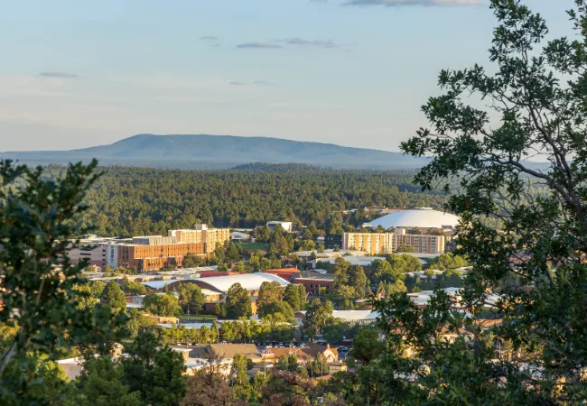
There is no shortage of hotels and resorts in Sedona, but it can be a pricey place to stay the night. For slightly less expensive options, check out the nearby communities of Oak Creek and Cottonwood.
Or a bit further afield is Flagstaff, about 40 minutes away, which is a great home base if you’re exploring other areas such as the Grand Canyon.
Forest Passes & Fees
The Red Rock Pass will be your friend for several of Sedona’s parking lots. State parks charge their own day-use fee, as do a handful of especially popular stops such as the West Fork trailhead.
Seasonal Considerations & Crowds
Sedona receives millions of visitors each year, and the parking lots at trailheads do not reflect that.
Parking can be challenging, especially on the Red Rock Scenic Byway.
One alternative is to use the free Sedona Shuttle that takes people to the most popular trailheads.
Sedona’s roads are accessible year-round. If you’re traveling during winter, it’d be a good idea to check the forecast.
Snow is a possibility, and it could slow things down in Oak Creek Canyon, especially.
Packing Essentials for Scenic Drives
Make sure you’re well provisioned with water and snacks. This is the desert after all, and you need to stay hydrated.
Recap & Route Recommendation
So which scenic drive will you tackle? The iconic formations along Red Rock Scenic Byway? The epic drive through Oak Creek Canyon? Or the serene nature of Red Rock Loop Road?
- Red Rock Scenic Byway: 7.5 miles, 20 minutes, easy
- Oak Creek Canyon: 16 miles, 30 minutes, moderate
- Red Rock Loop Road: 8 miles, 20 minutes, easy
Explore Sedona with Shaka Guide
If you want to explore all three scenic drives, Shaka Guide’s self-guided driving tour of Sedona has you covered.
Starting either from the north, south, or the town of Sedona itself, we guide you to Sedona’s most amazing stops, and some off-the-beaten-path gems as well.
It’s all at your own pace, and your own interest level. We’d love for you to join us.


Matt Caracciolo is a travel writer based in Ohio and author of the Shaka Guide tour for Yosemite. Born and raised in Columbus, Matt fell into travel writing while teaching English abroad in South Korea.
He has written two travel books, including the Moon Ohio guidebook, and enjoys writing and editing tours for Shaka Guide. Matt follows Mark Twain’s belief that “travel is fatal,” embracing travel as a way to learn more about the world and ourselves.
Ready to explore Sedona?
Take Shaka Guide’s Sedona Audio Tour for turn-by-turn directions, local stories, and the freedom to explore at your own pace.
Visiting more parks in the region?
Don’t miss our Arizona Tour Bundle — it includes tours for Grand Canyon, Horseshoe Bend, and many more!
Still planning?
Check out our Sedona Itinerary and Know Before You Go guide to prep for your trip.
Have questions?
We’re happy to help — email us at aloha@shakaguide.com.
Like this article? Share it on Pinterest!

RELATED ARTICLES:
Hiking Devil's Bridge in Sedona
Driving to Sedona from Phoenix
Driving Between the Grand Canyon and Sedona
The Ultimate Sedona, Arizona Travel Guide


 to fuel your ride
