


2-Day Grand Canyon South Rim Itinerary & Travel Guide

- Plan your visit between March and October for the best Milky Way visibility, especially during a new moon.
- Sotol Vista Overlook and Mule Ears Viewpoint offer wide, unobstructed night skies with easy roadside access.
- Arrive after sunset and give your eyes at least 20 minutes to fully adjust to the darkness.
- Use red-light flashlights only and turn off car headlights to preserve night vision and dark skies.
- Check weather conditions and park alerts before heading out, and dress for cooler nighttime temperatures.
TABLE OF CONTENTS
- Day One: Starting the tour in Flagstaff, Arizona
- Day Two: From Flagstaff to Desert View
- Things To Remember
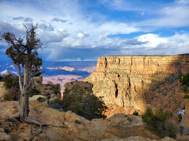
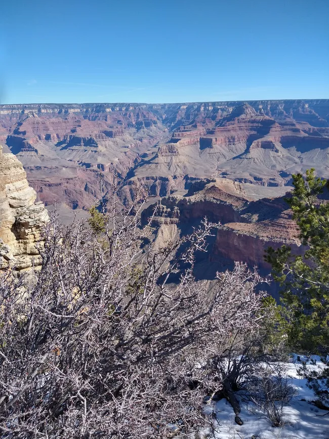
So… you’ve made it to the Grand Canyon. Get ready—because no matter how many photos you’ve seen, nothing prepares you for the real thing.
Even if someone once called it “a big hole in the ground,” the moment you walk up to the rim, your jaw will drop.
And maybe your stomach too—that’s a mile straight down.
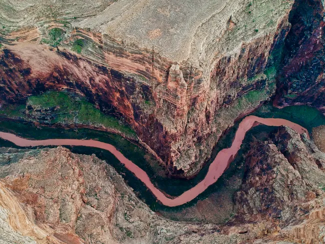
This canyon is massive: 277 miles long, up to 18 miles wide, and so breathtakingly deep.
What does all that mean to you?
Well, you could stack three Empire State Buildings inside and still have room for a flock of California condors to cruise by.
So yes…it is a big hole in the ground, but it’s a heck of a lot more than that.
Now, here’s the game plan. With two days, we’ve got time to see all the famous viewpoints and even take a few of its famous hikes.
If you’re up for it, we can even swing by two national monuments, but, hey, we’ll let you decide that one.
As always, feel free to customize this itinerary how you see fit.
Have more or less time?
Check out our 3-day and 1-day itineraries as well.
Two Unforgettable Days at the South Rim
Shaka Guide gives you the freedom to explore the Grand Canyon your way—no tight schedules, no tour group, just you, your loved ones, and the open road.
We’ve even built in four different starting points so you can jump in wherever you are.
Each route has its own highlights, from roadside stops to big-name viewpoints.
For this itinerary, though, we’ll imagine you’re starting out in Flagstaff, Arizona, heading north on Highway 89.
From there, we’ll guide you step by step all the way to the canyon rim—with stories, sights, and plenty of chances to pull over and explore along the way.
Day One: Starting the tour in Flagstaff, Arizona
1. Feelin’ Fine on 89
- Approximate Time: 1 hour
Cruising up Highway 89, the trees thin out and the land opens wide.
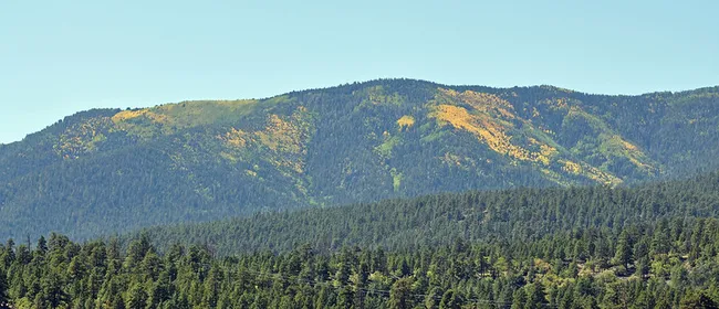
Off to your left, those big mountains on the horizon? Those are the San Francisco Peaks—the tallest in Arizona, and on a clear day you can see every ridge and curve.
They kind of just float above the desert, keeping watch while you roll north.
Along the way, you can swing by two beautiful National Monuments–highly recommended!
Have a little time before you head up?
I recommend checking out Elden Pueblo—an ancient Sinagua village with stone rooms and kivas where families lived a thousand years ago.
It’s just on the outskirts of town.
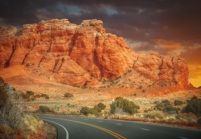
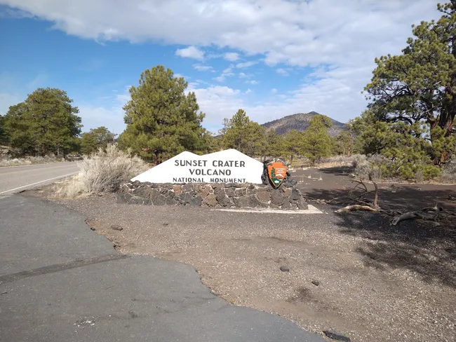
2. Sunset Crater National Monument
 Jessica Conaway
- Approximate Time: 1-2 hours
Next up is Sunset Crater Volcano—and yep, that name’s as cool as it sounds.
About 900 years ago, this quiet landscape got rocked by a massive eruption that sent lava, ash, and cinders flying for miles.
The cone today looks almost painted… dark lava rock splashed with rusty reds and oranges that almost seem to glow.
You can wander short trails through old lava flows and twisted rock, where it feels a little like walking on another planet.
Not quite 2 full days to spend? Go ahead and skip stops 2 and 3, and head on to the main event.
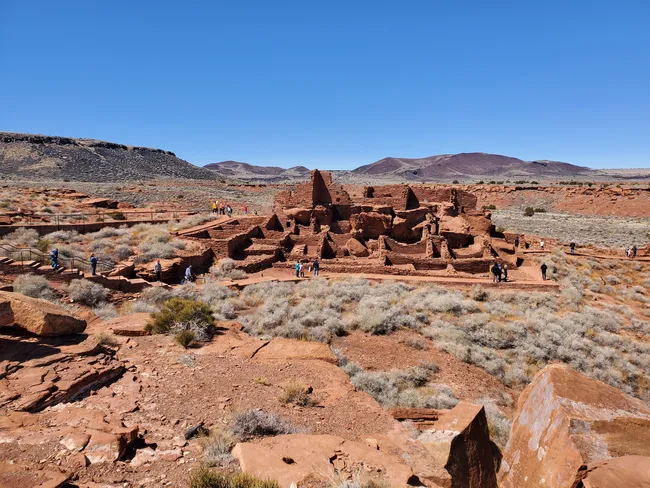
3. Wupatki National Monument
 Rachel Ennis
- Approximate Time: 1-2 hours
The next optional stop on 89 is Wupatki National Monument.
This spot was once home to the Sinagua people, who built pueblos and traded across the region.
The Wupatki Pueblo, the largest in the area, features over 100 rooms and a ceremonial ballcourt—the northernmost of its kind in North America.
Today, you can explore the well-preserved ruins, including Wukoki and The Citadel.
You can even feel the earth “breathe” at the blowhole, where cool air escapes from underground chambers.
It's a quiet, wide-open place to connect with the past. The trails are easy, short, and well-worth stopping for.
4. Little Colorado River Gorge Overlook
 Shutterstock Image
- Approximate Time: Up to 1 hour
Your journey kicks off just outside Grand Canyon National Park, on Navajo Nation land.
Here, the Little Colorado River has carved its own dramatic gorge—narrow, deep, and rugged, like a teaser trailer for the main canyon up ahead.
Local Navajo vendors often set up here, selling handcrafted jewelry, pottery, and art.
Bring a few dollars in cash—both to support local artists and because card readers aren’t always available out here.
5. Grand Canyon Welcome Sign
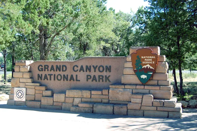
- Approximate Time: 5 minutes
Hey, hey! You don’t want to miss that photo-op!
6. Desert View Drive
- Approximate Time: 2–3 hours, with stops
This 26-mile stretch of road is more than just a way from point A to point B—it’s a highlight reel of the Grand Canyon’s South Rim.
Along the way, you’ll find viewpoints that range from:
- intimate glimpses
- sweeping panoramas
- archaeological sites
- picnic areas
- and even historic towers
Whether you drive it straight through or stop at every single overlook, it’s the perfect finale—or beginning—to your canyon adventure.
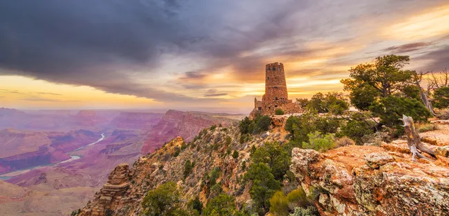
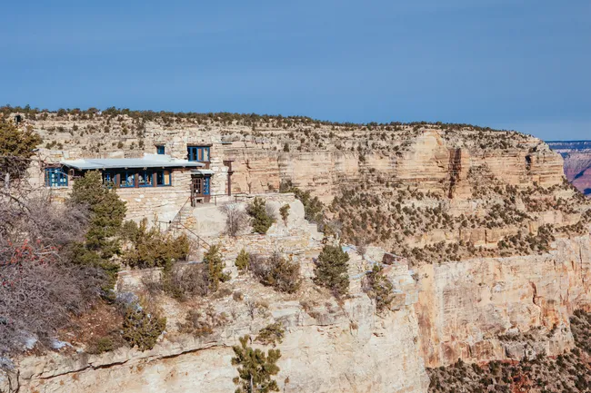
7. Desert View Watchtower
 Shutterstock Image
- Approximate Time: Up to 1 hour
Mary Colter’s Desert View Watchtower is more than a building—it’s a masterpiece of stonework that echoes ancient Puebloan architecture.
Step inside to find murals by Hopi artist Fred Kabotie, explore the small shop, or climb the tower’s spiral stairs for a jaw-dropping 360-degree view.
Outside, take in sweeping panoramas of the Colorado River far below.
Before leaving, pause at the memorial plaque honoring those lost in the tragic 1956 TWA crash.
The inside of the tower is open seasonally and typically from 8 a.m. to sunset.
Hours can vary, so check at the entrance station or the Grand Canyon Conservancy website before your visit.
8. Navajo Point
 Shutterstock Image
- Approximate Time: 5-10 minutes
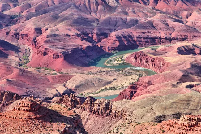
At 7,461 feet, Navajo Point is the highest overlook along Desert View Drive.
From here, the views seem endless.
You can look north to see the Colorado River make a wide bend, or west across miles of cliffs glowing in warm desert colors.
Turn back east, and you’ll also catch one of the best views of the Desert View Watchtower, standing tall at the canyon’s edge.
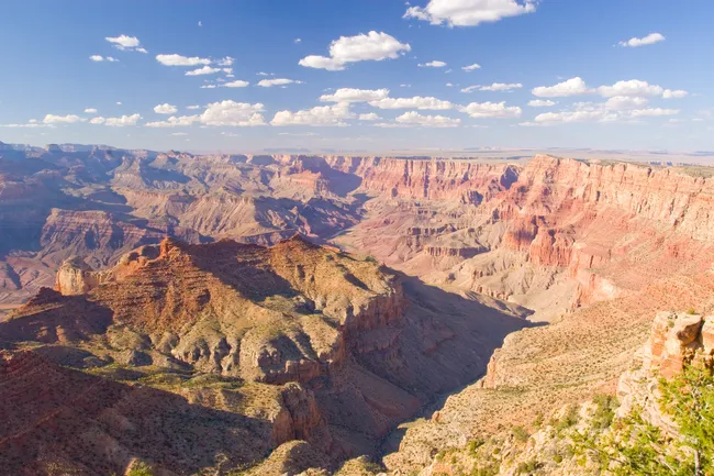
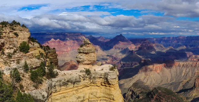
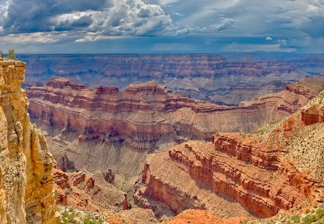
9. Lipan Point
 Shutterstock Image
- Approximate Time: 5-10 minutes
One of the widest panoramas on the South Rim, Lipan Point lets you trace several bends of the Colorado River.
On clear days, you may hear Hance Rapids roaring below, and the canyon’s colorful Supergroup rocks are especially visible here.
At 7,360 feet, it’s also a favorite sunrise spot.
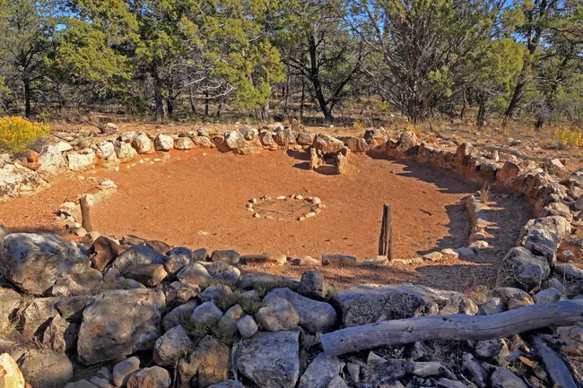
10. Tusayan Ruin
 Shutterstock Image
- Approximate Time: 15-30 minutes
Step back nearly 900 years at the Tusayan Ruin, once home to a small Puebloan village.
The short interpretive trail winds among low stone walls.
The adjacent museum displays artifacts and tells the story of the people who lived and farmed here.
11. Moran Point
 Rachel Ennis
- Approximate Time: 5-10 minutes
Named for painter Thomas Moran, whose artwork helped inspire the creation of national parks, this overlook honors his influence.
It also showcases some of the canyon’s oldest exposed rocks—gneiss and schist that date back nearly 2 billion years.
The colors here are especially vivid at sunset, when the reds and purples blaze across the walls.
12. Buggeln Picnic Area
- Approximate Time: 5-10 minutes
Tucked in a shady grove of ponderosa pines, Buggeln Picnic Area is a quiet break from the big overlooks.
Picnic tables are scattered among the trees, and glimpses of the canyon peek through.
If you brought your breakfast, this is a great place to stop and enjoy it!

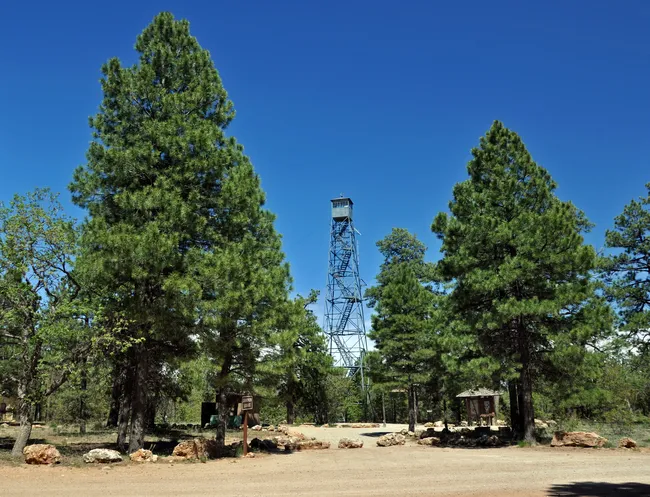
13. Grandview Lookout Tower
 Kaibab National Forest, Arizona
- Approximate Time: 15 -30 minutes
Built by the Civilian Conservation Corps in 1936, this fire lookout tower still stands tall in Kaibab National Forest.
About 10 miles from the Tusayan Ranger District, you can climb up the observation deck for a forest-framed view that stretches all the way to the canyon.
14. Grandview Point
 Shutterstock Image
- Approximate Time: 5-10 minutes
This overlook once hosted Pete Berry’s Grandview Hotel and copper mine, making it one of the earliest tourist stops on the rim.
Today, it’s remembered for its sweeping views—on quiet days, you can hear Hance Rapids crashing below.
15. Twin Overlooks
- Approximate Time: 10-15 minutes
Two quick pullouts double the wow factor.
Each stop offers a slightly different angle into the canyon, making this a fun place to hop out, snap photos, and head on out.
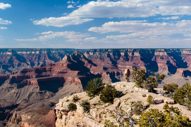
16. Duck on a Rock Viewpoint
 Shutterstock Image
- Approximate Time: 5-10 minutes
Nature’s humor at work: a chunk of Kaibab limestone eroded into the uncanny shape of a duck.
Once you see it, you can’t unsee it.
This is a great one for kids—see who can “find the duck” first.
17. Yaki Point & South Kaibab Trail (Shuttle access only)

- Approximate Time: 30 minutes-full day (hiking)
One of the most spectacular overlooks on the South Rim, Yaki Point gives you front-row views without the traffic.
Since private vehicles aren’t allowed, you’ll take the shuttle to reach this stunning viewpoint.
It’s also the trailhead for the South Kaibab Trail, one of the most iconic hikes into the canyon.
Hiking or not, this is a spot you won’t want to miss.
18. Pipe Creek Vista
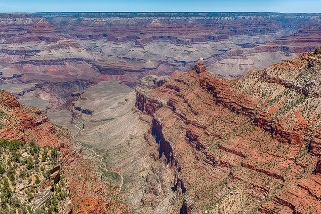 Shutterstock Image
- Approximate Time: 10-20 minutes
Your last major overlook along Desert View Drive, Pipe Creek, is a great place to stretch your legs and ease into the canyon’s immensity.
From here, you’ll see the South Kaibab Trail zigzagging down toward the Colorado River.
19. Grand Canyon Visitor Center & Mather Point
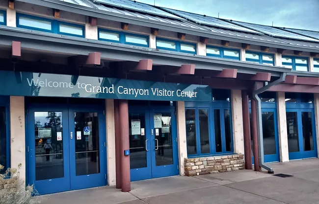 Rachel Ennis
- Approximate Time: Up to 1 hour
This is the spot where the canyon’s sheer scale finally sinks in.
Your brain might actually stall for a second as it tries to process the endless sweep of cliffs, colors, and dizzying drop-offs.
The wooden platforms here are perfectly placed for photos, whether it’s sunrise, sunset, or anything in between.
They’ll make you look like a pro without even trying.
Before stepping out, pop into the Visitor Center theater for the 20-minute orientation film.
It’s short, but it gives you the “aha” moments about what’s beneath your feet. P.S.-So does the Shaka Guide tour. Just sayin’.
Take a glance at the schedule to see when rangers give their geology talks.
They’ll explain why some rock layers look striped and how the Colorado River carved this wild masterpiece.
Step inside and dive into the interactive exhibits—fun for
- kids
- adults
- and anyone who likes to poke, prod, and explore
Wander around the relief model to see the canyon in full 3D glory, check out the hands-on desert critter displays, and pick up some real rock samples.
20. Rim Trail Walk to Yavapai Geology Museum
 Shutterstock Image
- Approximate Time: 1–2 hours
Alright, after exploring the visitor center, you’ll head about 0.5 miles (roughly 20–30 minutes) west along the Rim Trail.
This pleasant walk keeps changing your view of the canyon, each turn revealing new angles and surprises.
A must-see stop along the way is the Yavapai Museum of Geology.
Inside, you’ll find the park’s most detailed geological timeline.
It includes fossils and rock core samples that illustrate the canyon’s two-billion-year story.
The museum’s windows are deliberately positioned to frame canyon features, so the building itself becomes a viewing tool.
Don’t miss the small outdoor amphitheater tucked nearby.
In summer evenings, rangers give talks that dive into Native American connections to the canyon and early scientific expeditions.
Day Two: From Flagstaff to Desert View
1. Second Start in Flagstaff/Fort Valley
 Faina Gurevich
- Approximate Time: 40 minutes.
Head north on Highway 180 through old lava fields with views of Humphreys Peak, Arizona’s tallest mountain.
The road then opens into wide meadows—prime elk country at dawn—before linking up with Highway 64, your final stretch to the South Rim.
2. Head Back to Mather Point
 Jessica Conaway
- Approximate Time: 1–2 hours
Did I mention this spot is also legendary for sunrises? It’s worth the early wake-up.
Can’t manage it? No worries. Head on to the next stop.
This is a great spot not only for sunrise, but it also has tons of parking. Every inner-park shuttle route stops here, making it easy to access.
In the off-season, it’s not as big a deal, but in summer, driving and parking can be extra challenging.
When you’re done, hop on the orange shuttle to head to the Yavapai Geology Museum, or take your own vehicle.
Just know there’s not quite as much parking, so if you’re coming in late, it could be full.
Writer's Tip: Hungry? Sleepy? Get some breakfast and a cup o’ joe at Bright Angel Cafe, then head on out.
3. Trail of Time
- Approximate Time: 1-2 hours
Start at the "present day" marker near the geology museum and walk backward through time for a unique perspective on Earth's history.
Bronze markers embedded in the pavement mark major geological events, while the actual rock samples let you touch pieces of Earth's ancient history.
The path connects seamlessly with Grand Canyon Village's historic buildings, making it easy to combine education with shopping or dining.
The trail surface stays level and accessible for wheelchairs and strollers.
4. The Grand Canyon Village
- Approximate Time: Up to 4 hours
Grand Canyon Village is where South Rim tourism really began.
More than a hundred years later, it still feels like the canyon’s front porch. Here you’ll find:
- old stone buildings
- historic lodges
- Native art
- gift shops
- and a few restaurants where travelers have been grabbing a meal for generations.
It’s also the only spot inside the park with full services—so if you need food, souvenirs, or just a place to rest, this is it.
 Rachel Ennis
Walking around the village is like flipping through the canyon’s human history, from early railroad days to the rustic designs of Mary Colter.
Your Shaka-Guided tour includes a walking tour of the village.
So be sure to bring your headphones to learn all about these historical stops!
Here’s a list of stops and how long they’ll take.
| Stop | Time | Description |
|---|---|---|
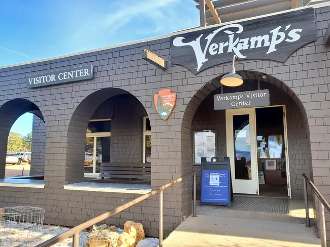
| Verkamp’s Visitor Center | 30 minutes |
Once a family home and long-running curio shop, Verkamp’s now highlights the stories of the early Grand Canyon community. Pop inside for exhibits and refill your water bottles before exploring the rim. |
| Hopi House | 30 minutes |
Built by Mary Colter in 1904, this “Indian Arts Building” echoes the style of an ancient Pueblo village. Today it’s home to Native American art, handmade crafts, and a small gift shop. |
| El Tovar Hotel | 10 minutes |
Opened in 1905 as the South Rim’s first luxury hotel, El Tovar still impresses with its rustic design. Step inside to admire the architecture and browse the newsstand and gift shop. |
| Grand Canyon Train Depot | 15 minutes |
This historic depot marks where visitors arrived by rail over a century ago. The Grand Canyon Railway continues to follow the original route, offering a classic way to reach the rim. |
| Matrimony Heart Rock | 5 minutes |
A heart-shaped rock with a charming love story—perfect for a quick photo stop or a romantic pause. |
| Buckey O’Neill Cabin | 20 minutes |
Built in 1890 by a Rough Rider, this tiny log cabin is one of the oldest structures surviving on the South Rim. |
| Kolb Studio | 30 minutes |
Once the photography studio of Emery and Ellsworth Kolb, it now hosts an art gallery, bookstore, and small gift shop with canyon views. |
| Mary Colter’s Lookout Studio | 30 minutes |
Mary Colter designed this 1914 building as a place to rest and take in the canyon. Today, visitors can still enjoy the views and browse the gift shop inside. |
| Bright Angel Lodge | 10 minutes |
Constructed in 1935 as a more casual alternative to El Tovar, Bright Angel Lodge features historic rooms, cozy cabins, two restaurants, a gift shop, and easy access to the rim. |
| Maswik’s Lodge | 10 minutes |
Dating to 1927, Maswik Lodge was built for travelers arriving by car. It still offers lodging, dining, and a gift shop just a short walk from the canyon edge. |
| Mule Barn | 10 minutes |
Not a formal stop, but worth passing by—especially for families—so you can see the Xanterra mules in their corral. |
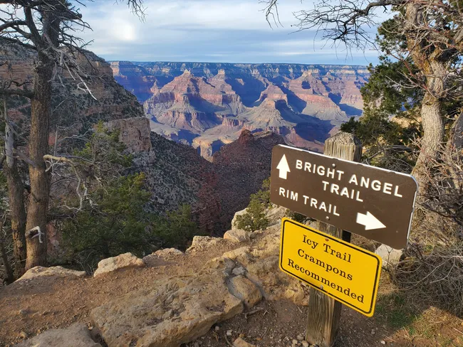
5. Hiking the Bright Angel Trail
 Rachel Ennis
- Approximate Time: Up to 6 hours
One of the most iconic experiences at the South Rim. Bright Angel Trail offers spectacular views of the canyon’s layers and wildlife.
While many hikers focus on the descent, even a short walk along the upper sections is worthwhile.
These higher stretches give you unique views of canyon walls and side canyons that you won’t get from the rim alone.
The trail is historically significant, too—it follows a route originally used by Native Americans and later by early tourists traveling from the South Rim lodges.
Along the way, you’ll see old stone retaining walls and remnants of historic rest houses.
For casual day-hikers, going just a mile or two down provides a taste of the canyon interior without the strain of a full descent.
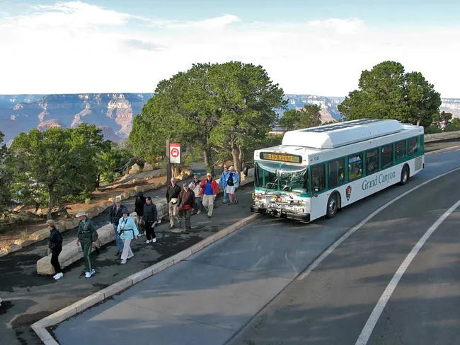
6. Hermit Road
- Approximate Time: 3 hours-5 hours
All of the viewpoints west of the Grand Canyon Village are along Hermit Road.
Now, Hermit Road is amazing, to be sure.
So you want to leave yourself plenty of time for this one.
Unless you’re planning on doing a lot more hiking,
I’d shoot for arriving mid-to-late afternoon so you can enjoy the sunset.
Few things, though. From March through December, Hermit Road is only accessible by the red shuttle route.
I mean it—only.
No private vehicles are allowed.
But, as you know, your Shaka Guide tour will still work, even on a shuttle. Just don’t forget your headphones!
The shuttle runs every 15 minutes. For more info on this and other routes, check out our shuttle guide.
| Stop | Time | Description |
|---|---|---|
| Trail View Overlook | 10 minutes | First peek down Hermit Road! Spot the Bright Angel Trail zigzagging into the canyon, check out hidden side gullies, and watch sunlight dance across the rock layers. Quick stop, big wow. |
| Maricopa Point | 10 minutes | Peek out over the rim and spot remnants of the old Orphan Mine, a glimpse of the mining era from the early 1900s. |
| Powell Point | 15 minutes | Named for explorer John Wesley Powell, this spot is prime for sunrise or sunset magic,a nd your first view of the river along Hermit Road. Pull over, soak in sweeping canyon views, and imagine the adventures of those early explorers. Note: Want this to be your sunset stop? Head all the way down to Hermit’s Rest, and then come on back. Just remember not to miss your shuttle back! |
| Hopi Point | 15 minutes | One of the widest viewpoints on Hermit Road, Hopi Point stretches your perspective across the canyon. The cliffs here drop sharply and dramatically, so be sure to snap your photos! |
| Mohave Point | 10 minutes | One of the highest stops on Hermit Road, Mohave Point is a great place to pause and get a sense of the canyon’s scale. |
| The Abyss | 10 minutes | A narrow overlook that juts out over the canyon’s western side, The Abyss offers a clear view of the rock formations on both walls of the inner canyon. |
| Monument Creek Vista | 10 minutes | A small pull-off along Hermit Road with a view of Monument Creek cutting through the canyon. You can see how the side canyon channels water and shapes the rock layers—a neat glimpse of the forces carving the Grand Canyon. This viewpoint also marks the start of the backcountry hike known as the Greenway Trail. |
| Pima Point | 10 minutes | Pima Point gives a broad view of the Colorado River as it winds through the canyon. Fewer crowds make it a nice spot to pause, and you can spot the confluence of a few small side canyons cutting into the rim. |
| Hermit’s Rest | 20 minutes to a full day | The western end of Hermit Road, Hermit’s Rest was designed by Mary Colter in 1914 as a welcoming stop for visitors. Inside, there’s a small gift shop and snack area. Outside, the overlook offers wide views of the canyon’s west end. This is also where the Hermit Trail begins—a challenging, unmaintained route down to the river. No permit is needed for a day hike, but it’s only suitable for experienced hikers with plenty of water and proper gear. |
Things To Remember
- Your Shaka Guide Tour works on the shuttle or while driving by car!
- The Hermit’s Rest Shuttle leaves the transfer station every 10-15 minutes.
- Shuttles can get very crowded, so you may have to wait for an open spot.
- Don’t wait to return on the last shuttle!
Explore Grand Canyon with Shaka Guide
Plan your road trip around the Grand Canyon with Shaka Guide! If you have extra time, explore nearby tours like the North Rim, Page, or Sedona for even more incredible views.
Need something shorter or longer?
Choose our one-day itinerary or three-day itinerary to match your schedule.Skip the stress—download the tour and enjoy the adventure!


Jessica Conaway and Rachel Ennis first met at the Grand Canyon, researching their very first co-authored tour. What began as a shared awe for the landscape turned into a lasting creative partnership and friendship.
Today, they collaborate to uncover the stories behind the scenery—blending history, humor, and a deep love of storytelling into every tour they write.
Ready to explore Grand Canyon South Rim?
Take Shaka Guide’s Grand Canyon South Rim Audio Tour for turn-by-turn directions, local stories, and the freedom to explore at your own pace.
Visiting more parks in the region?
Don’t miss our Arizona Tour Bundle — it includes tours for Sedona, Monument Valley, and many more!
Still planning?
Check out our Grand Canyon South Rim One-Day Itinerary and Know Before You Go guide to prep for your trip.
Have questions?
We’re happy to help — email us at aloha@shakaguide.com.
Like this article? Share it on Pinterest!

RELATED ARTICLES:
The Ultimate Grand Canyon South Rim Travel Guide
Grand Canyon, North vs South Rim: Everything You Need to Know
The Best Views Grand Canyon South Rim
20 Things to Do at the Grand Canyon South Rim
Top 16 Grand Canyon South Rim Hikes
Hiking into the Grand Canyon South Rim
All About the Grand Canyon Shuttle Buses
How To Get From Las Vegas to Grand Canyon South Rim


 to fuel your ride
