


Black Canyon of the Gunnison National Park Itinerary

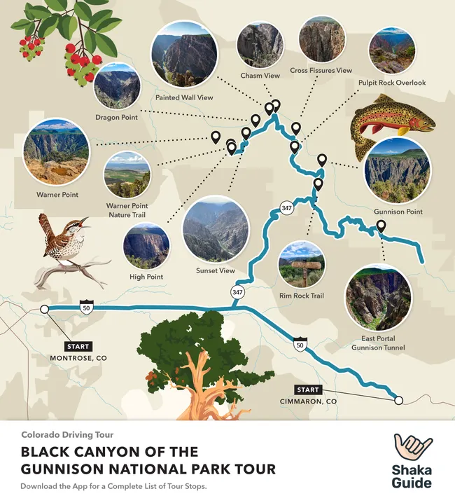
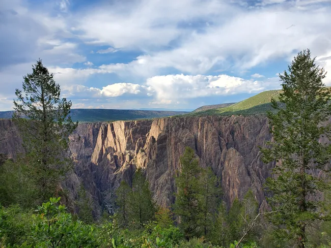
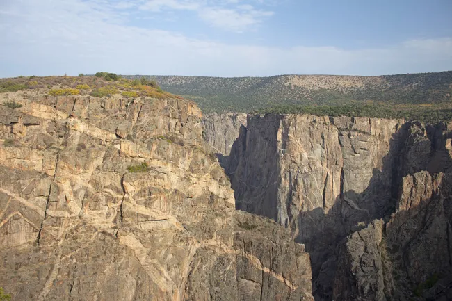
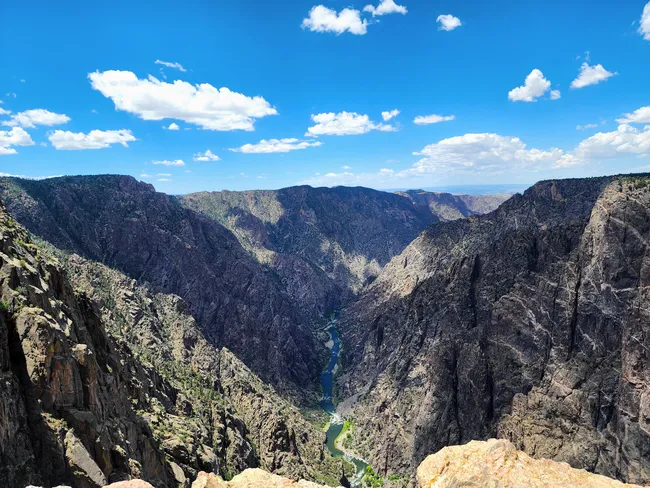
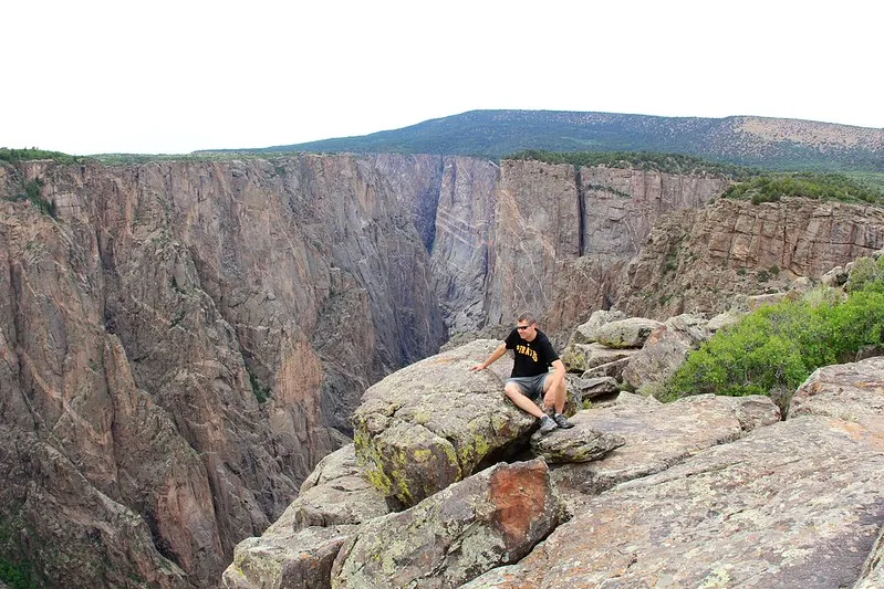
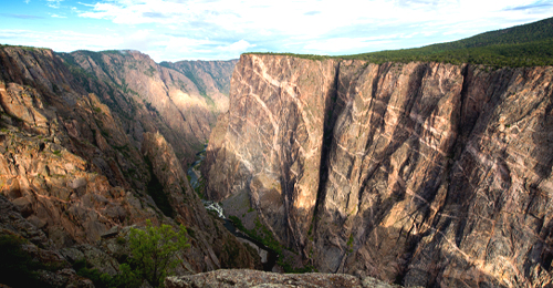
We’re kicking things off with the ol’ south side, the most accessible and visitor-friendly rim of Black Canyon. A paved scenic drive connects some of the park’s most iconic overlooks, short walks, and trailheads.
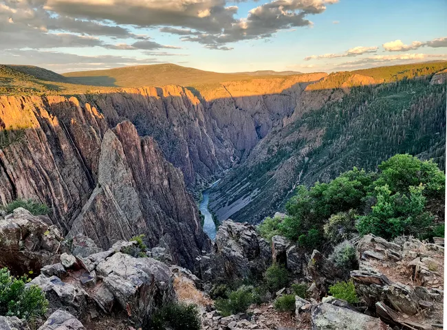
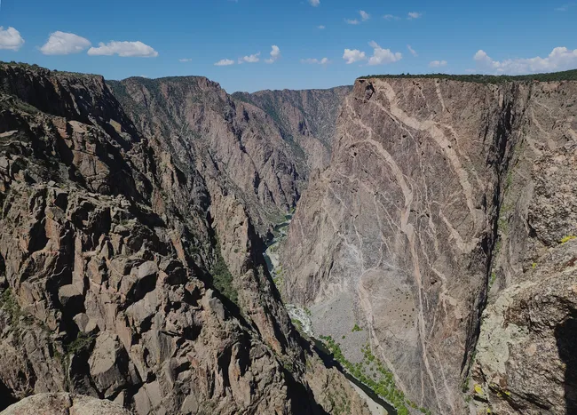
When you’re done being up and looking down, it’s time to head down and look up! The narrow, winding East Portal Drive takes you all the way down to the Gunnison River, giving you a new perspective on those awe-inspiring cliffs.
Black Canyon of the Gunnison Itinerary
Day 1
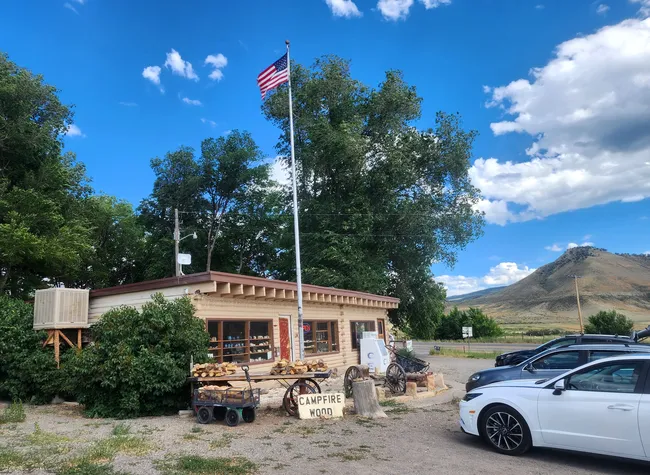
1. Black Canyon General Store
 Rachel Ennis
-
Duration: 20 minutes
Postcards? Check. Fossils? Check. Firewood? Check. This small, locally owned store has it all.
But most importantly, don't forget to check out the attached building to view some stunning local photography.
2. Up to the Entrance Station
Take a scenic drive up the plateau, passing idyllic fields, ranches, and Jones Summit. When it starts to level out, you'll be at the entrance station. Show your park pass and ID, and get ready for adventure.
3. South Rim Amphitheatre
This outdoor area hosts wonderful ranger-led night-sky programs. Don't miss out--Black Canyon is celebrated for its starry black skies!
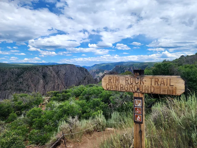
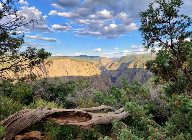
4. Rim Rock Trail
 Rachel Ennis
- Duration: 1 hour
Rim Rock Trail is a relaxing 1.7-mile out-and-back trail with jaw-dropping views of the canyon and the river way below.
It’s an easy hike, so you can enjoy the scenery without breaking a sweat. In the warmer months, keep an eye out for wildlife and wildflowers along the way!
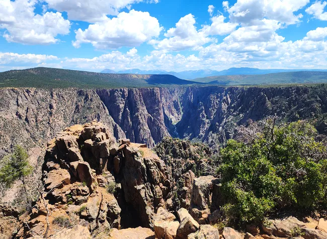
5. Tomichi Point
 Rachel Ennis
- Duration: 10 minutes
Tomichi Point is the perfect introduction to the Black Canyon of the Gunnison, offering panoramic views right from the park’s entrance.
Unlike some other viewpoints, it gives a sweeping perspective of the canyon’s dramatic depths without having to hike or walk.
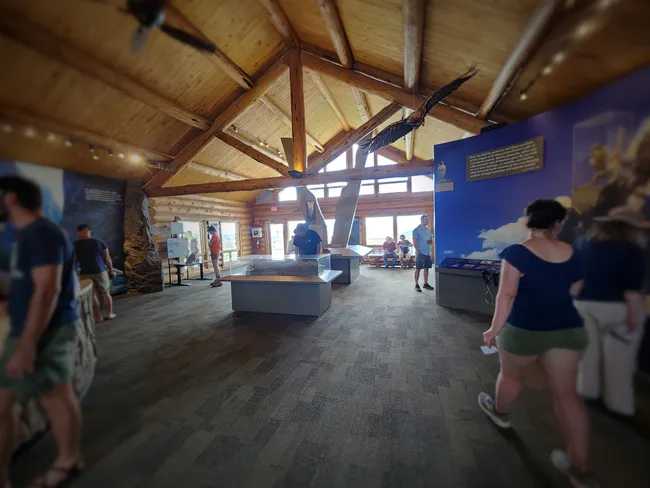
6. South Rim Visitor Center
 Rachel Ennis
- Duration: 20 minutes
The visitor center is a great way to settle in to your Black Canyon adventure, offering some amazing canyon views right from its deck. A really great stop to get adjusted to the height while having a nice, firm handrail to hold.
Inside, you’ll find exhibits on the park’s geology, wildlife, and history, along with helpful rangers ready to answer questions and share trail tips.
Don't forget to fill up your water bottle and hit the restroom before you leave!
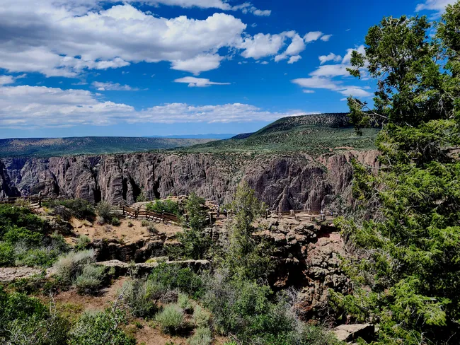
7. Gunnison Point Trail
 Rachel Ennis
- Duration: 10 minutes
The Gunnison Point Trail starts right from the Visitor Center and, in my opinion, is a definite do-not-miss. It's a short, 0.2-mile paved path leading to one of the park’s most iconic overlooks.
With its easy access and stunning views of the sheer canyon walls plunging into the Gunnison River, it’s perfect for all visitors, including those with little ones in tow.
8. Gunnison Point
 Rachel Ennis
- Duration: 10 minutes
Gunnison Point is just a short, flat walk behind the visitor center, and trust me—that heart-dropping, stomach-churning view straight down into the depths is unmissable. If you don’t do anything else here, do this!
9. Oak Flat Trail
 John Manard
- Duration: 2 hours
This moderate 2-mile trail is a great trail for those looking to spend some extra time on and just below the rim.
The trail winds through the gambel oak forest before opening to sweeping canyon vistas.
10. Pulpit Rock Overlook
 Rachel Ennis
- Duration: 10 minutes
Pulpit Rock Overlook is a dramatic vantage point where the canyon’s steep, rugged cliffs frame the Gunnison River far below.
Accessible and breathtaking, it’s a must-stop for capturing the raw power and beauty of Black Canyon’s geology.
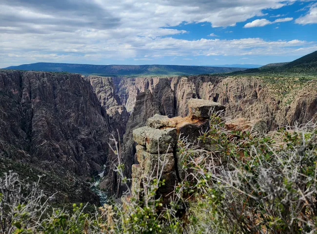
11. Cross Fissures View
 Rachel Ennis
- Duration: 10 minutes
Cross fissures are vertical cracks and fractures found in hard, brittle rock and formed under intense pressure, such as during the Laramide Orogeny.
Seen throughout the canyon, this is a particularly easy spot to appreciate them. No walk required.

12. Rock Point
 Rachel Ennis
- Duration: 10 minutes
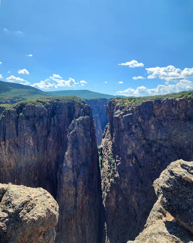
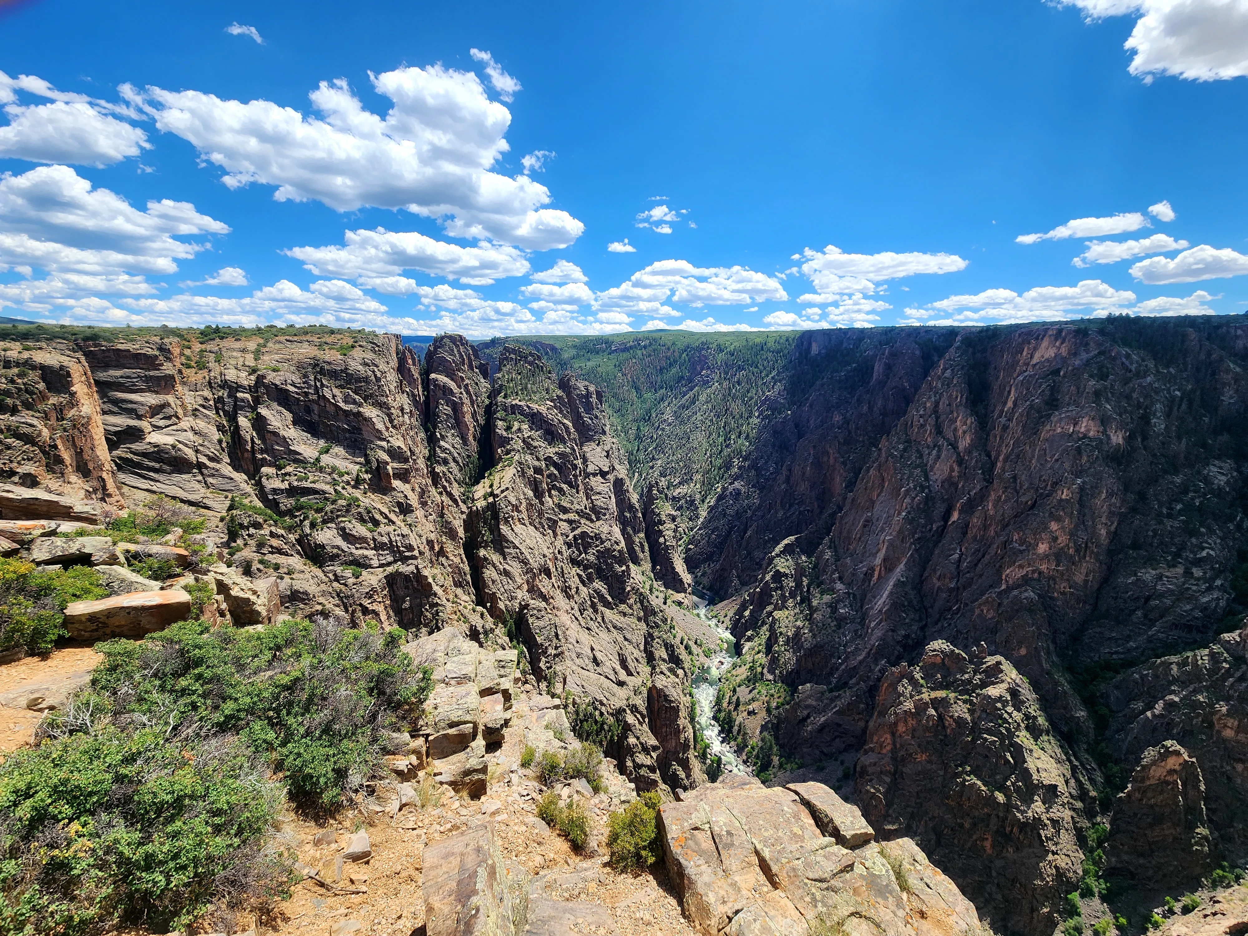
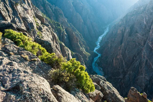
Rock Point Trail is a short walk—just over a quarter mile round trip—leading to a rocky outcrop that overlooks one of the most dramatic sections of the canyon, known as “The Narrows.”
Here, the canyon reaches its tightest point. Down at the bottom, the towering walls squeeze in to just 40 feet apart, making this one of the narrowest stretches anywhere in Black Canyon of the Gunnison.
13. Devil's Lookout
 English: NPS Photo, Public domain, via Wikimedia Commons
- Duration: 10 minutes
Devil’s Lookout Trail is a half-mile round trip that rewards you with incredible views straight down to the Gunnison River far below.
It’s also the place to spot a rare natural feature that many visitors completely miss—a natural phenomenon known as the Dragon’s Tongue.
14. Chasm View
 English: NPS Photo, Public domain, via Wikimedia Commons
- Duration: 10 minutes
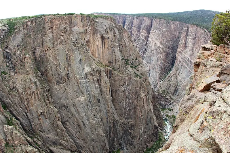
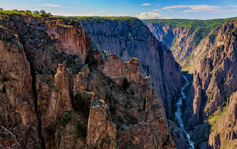
The Chasm View Overlook starts with a quick stroll through the pinyon-juniper forest, but when you reach the end, you’re rewarded with one of the most spectacular views in the canyon.
This overlook sits right at the edge of the steepest, narrowest part of the Black Canyon, where the cliffs drop a dizzying 1,820 feet down to the Gunnison River, separated by a mere 1,100 feet between each wall.
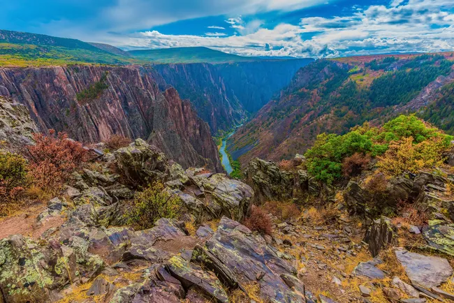
15. Painted Wall View
 Rachel Ennis
- Duration: 10 minutes
Ready to see a real masterpiece? Painted Wall Viewpoint offers a jaw-dropping look at the tallest cliff in Colorado, rising 2,250 feet above the Gunnison River.
The dark rock face is streaked with pale, pinkish bands of pegmatite that create the “painted” effect and give this towering wall its name.
Writer’s Tip: This is easily one of the most famous—and most photographed—views in the entire canyon. Be sure to stop here, and don’t forget your camera.
16. Cedar Point
 Rachel Ennis
- Duration: 10 minutes
The Cedar Point Trail is a short, moderate hike—just under half a mile round trip—leading to two great canyon overlooks.
You’ll get big views down into the canyon, with the Gunnison River winding far below and a close look at the rugged Cedar Cliffs rising across the gorge.
17. Dragon Point
 Rachel Ennis
- Duration: 10 minutes
The walk to Dragon Point Overlook is just a third of a mile round trip, and it’s a great spot to get a close look at the canyon’s streaks of pink pegmatite—especially when the setting sun lights up the cliffs.
Writer's Note: This is one of my top three recommended spots for watching the sunset, along with Sunset View and Painted Wall. Arrive early, and prepare for some wind...it can get breezy in the late afternoon!
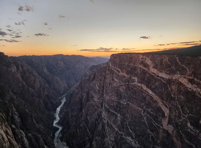
18. Sunset View
 Rachel Ennis
- Duration: 10 minutes
The westernmost viewpoint on the South Rim, this spot lives up to its name, offering a great view of the sunset over the canyon.
19. High Point
 Rachel Ennis
- Duration: 10 minutes
High Point is the highest overlook on the South Rim, offering panoramic views of the surrounding landscapes and the distant San Juan Mountains.
It’s the perfect spot to begin wrapping up your Black Canyon adventure, with a nearby picnic area to relax and enjoy the scenery.
20. Warner Point Nature Trail
 The Dye Clan, CC BY-SA 3.0 <https://creativecommons.org/licenses/by-sa/3.0>, via Wikimedia Commons
The Warner Point Nature Trail is a 1.5-mile round-trip hike with a bit of a climb—but the payoff is huge. At the end, you’ll be standing at the very edge of the canyon with sweeping views of Black Canyon, the Gunnison River, and the wide valleys beyond.
Along the way, the trail winds through a pygmy pinyon-juniper forest, with interpretive signs pointing out some of the fascinating plants, wildlife, and geology that make this rugged landscape so unique.
21. Warner Point
 Rachel Ennis
- Duration: 10 minutes
Warner Point sits right at the edge of Black Canyon, offering sweeping views down to the Gunnison River and out across the wide valleys beyond.
It’s the grand finale of the Warner Point Nature Trail, and the perfect spot to pause, catch your breath, and take in some of the most impressive scenery in the park.
22. East Portal Gunnison Tunnel
 Rachel Ennis
- Duration: 1 hour
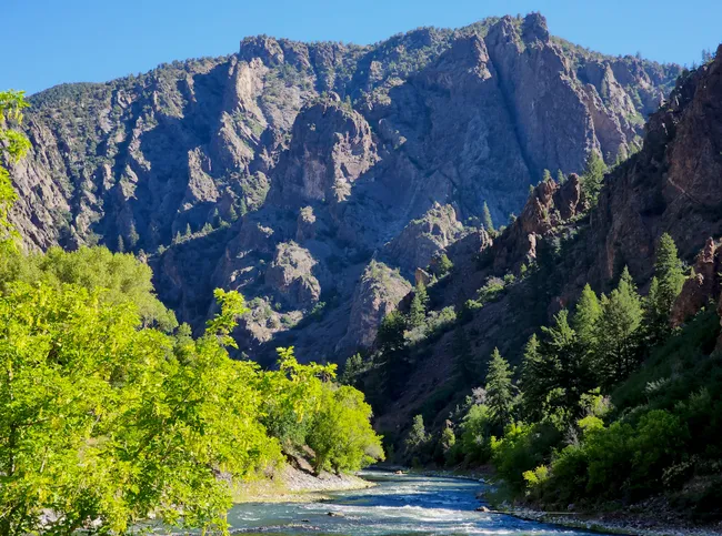
East Portal Drive is a steep, winding road that takes you right down to the Gunnison River, offering a close-up look at the canyon’s towering walls and lush riverside.
At the bottom, you’ll find the historic Gunnison Tunnel, an engineering marvel from 1909 that diverts river water to the Uncompahgre Valley—a testament to human ingenuity in this rugged landscape.
23. Keep driving to Crystal Dam
Enjoy all the small overlooks, river views, and astounding bottoms-up views of the canyon. Drive down to the dam gate, then turn around and head back up and out.
Day 2
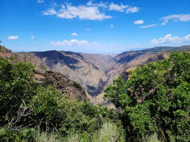
Today we’re exploring the North Rim—the quieter, wilder side of Black Canyon. A single scenic road leads to dramatic overlooks, peaceful trails, and some of the steepest views anywhere in the park.
Just keep in mind that this side of the canyon is pretty remote, with limited services—no food, gas, or shops—so make sure you’ve got everything you need before heading in.
1. Curecanti National Recreation Area Drive-Through
- Estimated Time: 45-90 minutes
Day two begins with a scenic approach through Curecanti National Recreation Area. Blue reservoirs, sweeping mesas, and wide-open Colorado skies ease you toward the canyon.
There are several overlooks to stop at, as well as a short trail. Put aside more time than the GPS recommends—you’ll want plenty of pictures.
2. Black Canyon North Rim Entrance Sign
- Estimated Time: 5–10 minutes
A quick but classic stop. The park sign marks your arrival to the quieter side of Black Canyon—and a quick photo is a great way to make the folks back home jealous.
3. North Rim Ranger Station
- Estimated Time: 10–15 minutes
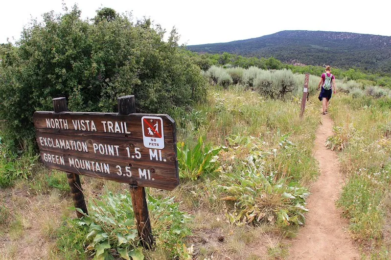
Swing by for maps, trail updates, and restrooms. This is also the starting point for the North Vista Trail, the North Rim’s most recommended hike.
4. North Vista Trail to Exclamation Point (Highly Recommended!)
- Estimated Time: 1.5–2.5 hours
If you do one real hike on the North Rim, make it this one. The North Vista Trail to Exclamation Point is a 3.2-mile moderate round-trip hike that winds through pinyon and juniper before suddenly opening to a spectacular overlook nearly 2,000 feet above the Gunnison River.
The name “Exclamation Point” feels pretty appropriate when you get there.
5. Optional Extension: North Vista Trail to Green Mountain
- Estimated Time: 3.5–5 hours total
Feeling ambitious? Continue beyond the exclamation point to Green Mountain. This 7.2-mile, fairly strenuous round-trip hike climbs about 900 feet to a summit with sweeping views of the canyon, the Uncompahgre Plateau, and distant San Juan Mountains.
6. Chasm View Overlook
- Estimated Time: 20–30 minutes
One of the North Rim’s most dramatic viewpoints. A flat half-mile loop trail (easy) leads to overlooks where the canyon walls plunge almost straight down toward the Gunnison River.
7. The Narrows Viewpoint
- Estimated Time: 15–20 minutes
Here, the canyon reaches one of its tightest squeezes. A short walk of about 1,000 feet round trip brings you to a viewpoint where the canyon is shockingly narrow and nearly 1,800 feet deep.
8. Balanced Rock View
- Estimated Time: 10–15 minutes
A quick and fun stop. From a very short, easy walk from the roadside pullout, you can see the famous balanced boulder perched dramatically along the rim, looking like it could topple at any moment.
9. Big Island View
 Shutterstock Image
- Estimated Time: 15–20 minutes
This overlook reveals jagged rock spires rising from the canyon floor like islands in a sea of stone. It’s an easy viewpoint stop with only a short walk from the parking area, and it’s also a great place to watch for soaring raptors.
Be sure to look across to Echo Canyon while you're there!
10. Island Peaks View
- Estimated Time: 15–20 minutes
A little over 1,000 feet round-trip walk leads to views of towering rock “islands” and the winding Gunnison River below. This stop also highlights the surprising ecosystems that cling to the canyon walls and stone formations.
11. Kneeling Camel View
- Estimated Time: 5-10 minutes
A playful final overlook where a rock formation resembles a camel resting along the rim. It’s an easy viewpoint with a short walk from the parking area, and a fun place to see how our brains find shapes in stone.
12. Optional: Deadhorse Trail
- Estimated Time: 2.5–3.5 hours
For those wanting a longer adventure, the Deadhorse Trail is a 6-mile round-trip hike (moderate difficulty) leading to a remote overlook above Deadhorse Gulch with views of the Gunnison River and surrounding canyon country.
13. End-of-Road Restroom & Turnaround Loop
- Estimated Time: 5–10 minutes
A practical stop at the end of the scenic drive before looping back toward the entrance.
14. Return Drive Along the North Rim Scenic Road
- Estimated Time: 20–30 minutes
Enjoy one last quiet drive through pinyon-juniper country and take in a final glimpse of the canyon before leaving the North Rim.
Explore the Black Canyon of the Gunnison with Shaka Guide
Black Canyon of the Gunnison, where it’s harder to say what’s more inspiring—the canyon itself, or the stories of human perseverance.
With Shaka Guide’s tour, you’ll explore this dramatic landscape at your own pace, uncovering both natural wonders and rich history along the way.
Whether you marveled at the sweeping views from the rims, ventured into the canyon’s depths, or cast a line into the Gunnison River, this experience offers something unforgettable for everyone.
Take the Black Canyon of the Gunnison Audio Tour with Shaka Guide and explore at your own pace with stories, directions, and must-see stops along the way.
Still planning? Check out our Know Before You Go guide to prep for an epic day.
Need help? Email us anytime at aloha@shakaguide.com!
Like this article? Share it on Pinterest!

Rachel is a storyteller, nature nerd, and park enthusiast who believes every trail has a tale. When she first visited Yellowstone, she was captivated by the steaming geysers, thundering waterfalls, and wild, wide-open spaces.
Since then, she’s explored national parks across the country, learning the history, ecology, and culture that shape these wild places. Now, she’s on a mission to share the stories that live in the land—and the places that make us feel small in the best way.


 to fuel your ride
