


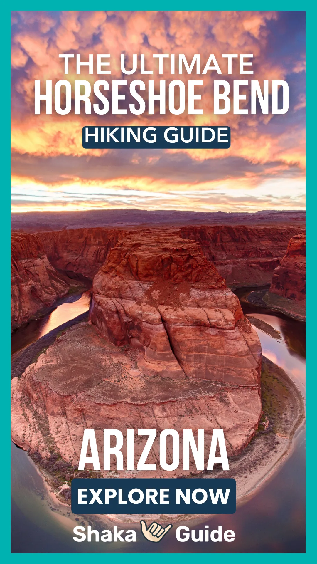
Hiking Horseshoe Bend: Everything You Need To Know


- The hike is short at 1.5 miles round trip, but heat and sun exposure can make it more challenging.
- Visit at sunrise or sunset for cooler temperatures, fewer crowds, and the best lighting for photos.
- Bring plenty of water, sun protection, and sturdy shoes since the trail is sandy and exposed.
- Arrive early to secure parking, as the lot often fills quickly during peak travel seasons.
- Stay back from cliff edges and supervise children closely, as some areas remain unguarded along the rim.
TABLE OF CONTENTS
- How Long Is the Hike to Horseshoe Bend?
- What Is the Best Time to Visit Horseshoe Bend?
- How Do You Get to Horseshoe Bend?
- What Should You Pack for the Horseshoe Bend Hike?
- Best Hikes and Scenic Spots Near Horseshoe Bend
- Safety Tips for Hiking Horseshoe Bend
- FAQs About Hiking Horseshoe Bend
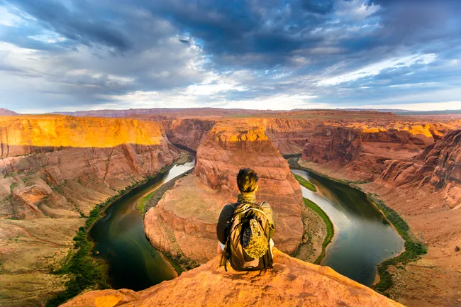
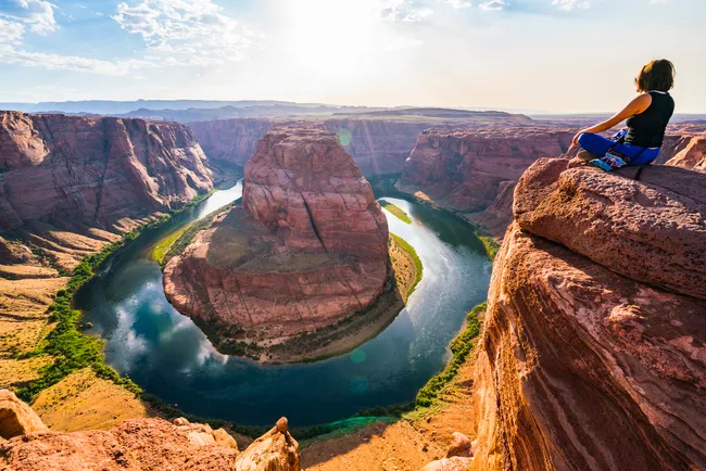
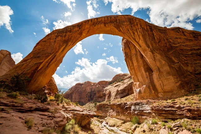
Horseshoe Bend is a truly unforgettable experience, defined by its iconic overlook and dramatic natural beauty.
Perched high above a sweeping curve of the Colorado River, the viewpoint offers a breathtaking panorama of the river carving its perfect horseshoe-shaped bend through deep red canyon walls.
Located just minutes from Page, Arizona, the overlook is reached by a relatively short, well-maintained trail suitable for most visitors.
What truly makes Horseshoe Bend special is its uniqueness: a perfectly sculpted river meander, sweeping desert views, vibrant sunsets, and an awe-inspiring sense of scale all in one spot.
How Long Is the Hike to Horseshoe Bend?
The hike to the scenic overlook at Horseshoe Bend is short, straightforward, and rewarding for visitors of all ages. The trail is approximately 1.5 miles round trip (about 0.75 miles each way).
 Shutterstock Image
In terms of difficulty, the hike is considered easy to moderate. While the trail is not steep, there is a gradual incline on the way to the overlook and a slight uphill return.
The path is mostly packed dirt and sand, and it is wheelchair accessible with some assistance due to the sandy sections.
The average time to complete the hike is 30 to 45 minutes round trip, though many visitors spend additional time at the overlook taking photos and enjoying the sweeping views of the Colorado River 1,000 feet below.
What Is the Best Time to Visit Horseshoe Bend?
The best time to visit Horseshoe Bend is in the early morning or late evening, when temperatures are cooler, and the lighting enhances the canyon’s dramatic colors. In the morning, the air is typically calmer and more comfortable, especially during spring and summer.
 Shutterstock Image
Soft light fills the canyon, making it a peaceful time to enjoy the overlook before larger crowds arrive.
Evening is especially popular for photography, as the warm glow of sunset brings out the rich reds and oranges in the sandstone cliffs and creates stunning contrasts along the Colorado River.
Midday visits can be challenging, particularly in the summer months. Temperatures often exceed 100°F (38°C), and the trail offers very little shade.
The sun is intense, and the desert heat can quickly lead to dehydration.
If visiting around midday, it’s important to carry plenty of water, wear sun protection, and plan for extra breaks. For comfort, safety, and the best photos, sunrise and sunset are ideal.
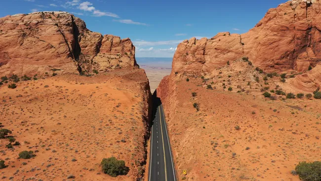
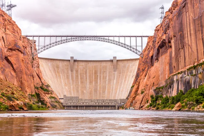
How Do You Get to Horseshoe Bend?
Horseshoe Bend is located just outside Page, Arizona, about 5 miles south of town along U.S. Highway 89. It’s easy to reach by car and well-marked with highway signage.
If you’re driving from Page, head south toward Flagstaff; the entrance and parking area will be on your right. From the south (Flagstaff direction), it will be on your left.
 Shutterstock Image
Access to Horseshoe Bend is through a large, paved parking lot managed by the City of Page. There is a parking fee, typically $10 per vehicle (motorcycles and walk-ins pay a reduced rate).
Fees are subject to change, so it’s a good idea to check ahead if you want the latest pricing.
After parking, visitors follow a 0.75-mile trail to the overlook. The lot includes restrooms and informational signage, but no shuttle service.
Arriving early is recommended, especially during peak travel seasons, as parking spaces can fill quickly.
What Should You Pack for the Horseshoe Bend Hike?
If you’re planning to visit Horseshoe Bend and hike to the overlook, packing thoughtfully will help ensure a safe and enjoyable experience. Water is the most important item to bring. The desert climate around Page, Arizona, can be extremely hot and dry, especially from late spring through early fall. Bring more water than you think you’ll need, as there is little shade along the trail.
 Shutterstock Image
Sun protection is also essential. Pack sunscreen, sunglasses, and a wide-brimmed hat to shield yourself from the intense Arizona sun.
Lightweight, breathable clothing is recommended to stay cool and comfortable.
Wear sturdy, closed-toe shoes with good traction.
The trail is mostly packed dirt and sand, and proper footwear will help with stability, especially on the slight incline returning from the overlook.
Don’t forget your camera or smartphone, as the panoramic views of the Colorado River are unforgettable. A small backpack is helpful to carry your essentials comfortably during the 1.5-mile round-trip hike.

Best Hikes and Scenic Spots Near Horseshoe Bend
1. Glen Canyon Rim Trail
 Shutterstock Image
The Glen Canyon Rim Trail is approximately 11 miles long in total, running through Page, Arizona, along the rim of Glen Canyon.
However, most visitors choose to explore shorter sections since there are multiple access points throughout town.
In terms of difficulty, the trail is considered easy. It is paved, well-maintained, and features mostly gentle elevation changes.
This makes it suitable for walkers, runners, families, and cyclists of all skill levels. While there are a few mild inclines, nothing is particularly steep or strenuous.
Because of its smooth surface and gradual grades, the Rim Trail is accessible to a wide range of visitors, including those with strollers or mobility devices (though assistance may be helpful in certain sections).
Overall, it’s a relaxed and scenic way to experience the canyon views without a challenging hike.
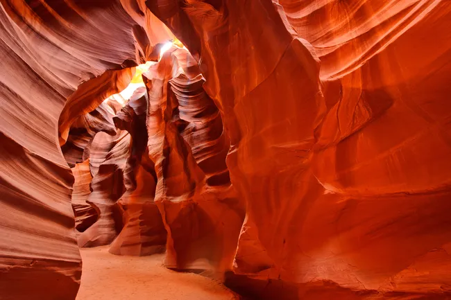
2. Antelope Canyon
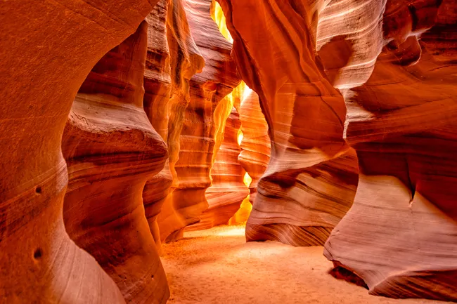 Shutterstock Image
Antelope Canyon hikes are guided walking tours through a stunning slot canyon near Page, Arizona. There are two main sections: Upper Antelope Canyon and Lower Antelope Canyon.
Both are relatively short in distance, typically less than 1 mile total walking, but the full guided experience lasts about 1 to 1.5 hours.
In terms of difficulty, Upper Antelope Canyon is considered easy. It features flat, sandy ground with no stairs, making it accessible for most visitors.
Lower Antelope Canyon is moderate, as it requires climbing several metal staircases and navigating narrow passageways.
Because Antelope Canyon is located on Navajo Nation land, visitors must join a guided tour, and advance reservations are highly recommended.
The average tour time is 60–90 minutes, depending on the operator and group size.
While the walking distance is short, you’ll move at a relaxed pace with frequent stops for photography and to learn about the canyon’s geology and history.
3. Wire Pass to Buckskin Gulch
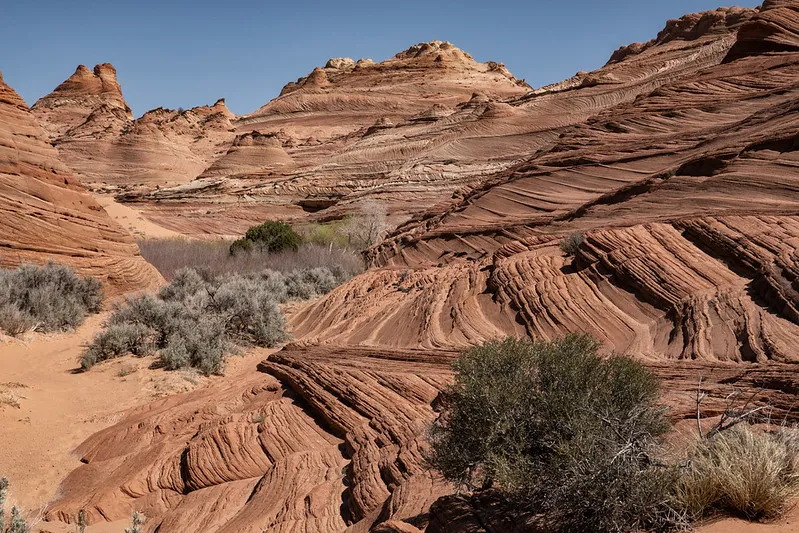
The Wire Pass to Buckskin Gulch trail is a stunning slot canyon hike located off House Rock Valley Road between Page, Arizona, and Kanab, Utah.
The hike begins at the Wire Pass Trailhead and travels through a narrow, winding slot canyon before connecting with Buckskin Gulch—one of the longest and deepest slot canyons in the world.
The hike to the Buckskin Gulch junction is approximately 3.4 miles round trip (about 1.7 miles each way). Many hikers choose to explore farther into Buckskin Gulch, which can significantly increase the distance.
In terms of difficulty, the trail is considered moderate. The route is mostly sandy with some uneven terrain, small rock obstacles, and occasional ladder descents.
Flash flooding is a serious risk, so always check weather conditions before hiking.
The average time for the standard out-and-back hike is 2 to 3 hours, depending on pace and time spent exploring the slot canyon sections.
4. Hanging Garden Trail
The Hanging Garden Trail in Page, Arizona, is a short but rewarding desert hike that leads to a rare spring-fed alcove tucked into the sandstone cliffs above Lake Powell.
The trail is approximately 1 mile round trip (about 0.5 miles each way). It begins near the Glen Canyon Dam area and follows a sandy, rocky path across slickrock and desert terrain before reaching the shaded rock wall where water seeps create a small “hanging garden” of lush vegetation.
In terms of difficulty, the hike is considered easy to moderate. The route is short, but the terrain can be uneven, with patches of sand and rock. There are some mild elevation changes, though nothing steep or technical.
The average time to complete the hike is 30 to 45 minutes round trip, depending on how long you spend enjoying the cool, shaded alcove. It’s a great option for a quick nature walk with a unique ecological feature.
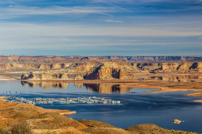
5. Lake Powell Viewpoints
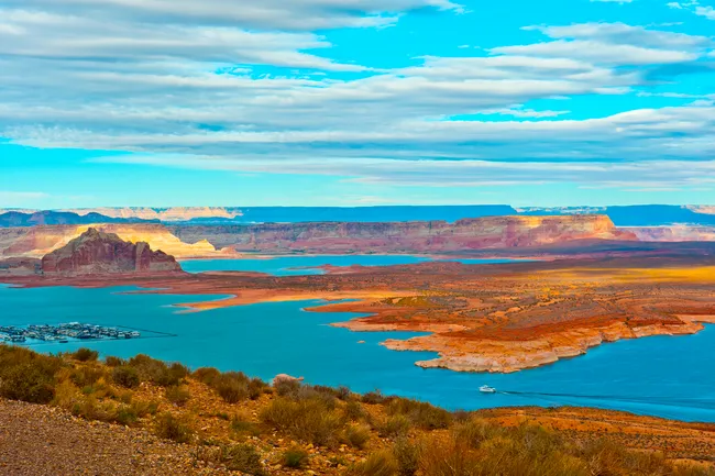 Shutterstock Image
The Lake Powell viewpoints around Page, Arizona, offer several easy-access spots to take in sweeping views of the lake’s blue waters against dramatic red rock canyon walls. Popular viewpoints include:
- Wahweap Overlook
- Glen Canyon Dam Overlook
- overlooks along Lakeshore Drive
Most viewpoints require little to no hiking. Some are located directly adjacent to parking areas, while others involve a short walk of less than 0.5 miles round trip.
Because of this, they are considered easy and suitable for visitors of all ages and mobility levels.
If a short walk is required, the average time spent is typically 15 to 30 minutes, depending on how long you stay to enjoy the scenery and take photos.
These viewpoints are especially beautiful at sunrise and sunset, when the light enhances the contrast between the deep blue water and the surrounding sandstone formations, making them ideal for casual sightseeing and photography
Safety Tips for Hiking Horseshoe Bend
Hiking in and around the Horseshoe Bend area is an unforgettable experience, but safety should always be a top priority.
The overlook sits approximately 1,000 feet above the Colorado River, and while portions now have railings, many areas along the rim remain exposed.
Always stay back from cliff edges, keep a firm footing, and supervise children closely.
Avoid standing on unstable rock ledges or stepping backward for photos without checking your surroundings.
Summer heat is another serious concern. Temperatures in Page, Arizona, frequently exceed 100°F (38°C), and the trails offer little shade.
Bring plenty of water—more than you think you’ll need—and drink regularly, even if you don’t feel thirsty. Wear sun protection, including sunscreen, a hat, and sunglasses.
It’s also important to practice Leave No Trace principles. Stay on designated trails, pack out all trash, and respect the fragile desert environment.
Checking weather conditions, especially for flash flood risks in slot canyons, is essential before heading out.
FAQs About Hiking Horseshoe Bend
 Shutterstock Image
How crowded does Horseshoe Bend get?
Horseshoe Bend is one of the most popular attractions near Page, Arizona, and it can get quite crowded—especially between late morning and sunset.
Spring, summer, and fall see the highest visitation. Midday and sunset are typically the busiest times, with full parking lots and heavy foot traffic. For fewer crowds, visit at sunrise or during the off-season winter months.
Is Horseshoe Bend kid-friendly?
Horseshoe Bend is generally kid-friendly, thanks to its short 1.5-mile round-trip trail and well-maintained path. However, parents should use caution near the overlook, as some cliff edges remain exposed despite installed railings.
Bring plenty of water, sun protection, and sturdy shoes. With supervision, it’s a memorable and manageable adventure for families with children.
Can you bring pets on the trail?
Yes, pets are allowed at Horseshoe Bend, including on the trail to the overlook. Dogs must be kept on a leash at all times, and owners are required to clean up after them.
Keep in mind that the trail is exposed with very little shade, and desert temperatures can become extremely hot—especially in spring and summer. The ground can heat up quickly and may burn your dog’s paws.
Bring plenty of water for both you and your pet, and consider visiting during the cooler morning or evening hours.
Also, be cautious near the rim, as some areas have exposed cliff edges. Always keep pets securely leashed and under control for their safety.
Do you need a permit to hike Horseshoe Bend?
No, you do not need a reservation to hike to the Horseshoe Bend overlook.
Access is first-come, first-served through the main parking lot off U.S. Highway 89 near Page, Arizona.
Visitors simply pay the parking fee (typically per vehicle) upon arrival and then walk the 0.75-mile trail to the overlook.
However, during peak seasons (spring through fall) and around sunset, the parking lot can fill up.
When that happens, you may have to wait for a space. Arriving early in the morning or later in the evening can help you avoid delays and larger crowds.
Can you see Horseshoe Bend without hiking?
No, you cannot see Horseshoe Bend directly from the parking lot or highway. To reach the iconic overlook, you must walk the 0.75-mile trail (1.5 miles round trip) from the parking area. The path is wide and well-maintained, but there is no roadside viewpoint or shuttle access.
The canyon rim sits beyond a small rise, so the view doesn’t appear until you reach the overlook itself.The hike is considered easy to moderate and typically takes 30–45 minutes round trip, making it manageable for most visitors.
If mobility is a concern, the trail is designed to be accessible with gradual grades, though sandy sections may require assistance.
Explore with Shaka Guide
Shaka Guide’s Horseshoe Bend and Lake Powell self-guided audio tour turns your phone into a personal guide as you explore scenic northern Arizona at your own pace.
The GPS-triggered narration leads you through multiple stops, including Horseshoe Bend, Glen Canyon Dam overlooks, Wahweap Marina, and historical sites like the John Wesley Powell Museum, sharing stories about geology, culture, and local history along the way.
You can customize your day, choosing which stops to make and how long to linger, with offline maps and tips that work without cell service.
The tour typically takes several hours and is ideal for those who want flexible, informative sightseeing without a traditional guided group.
Ready to explore Horseshoe Bend?
Take Shaka Guide’s Horseshoe Bend Audio Tour for turn-by-turn directions, local stories, and the freedom to explore at your own pace.
Visiting more parks in the region?
Don’t miss our Arizona Tour Bundle — it includes tours for Sedona, Grand Canyon South Rim, and many more!
Still planning?
Check out our Horseshoe Bend Itinerary and Know Before You Go guide to prep for your trip.
Have questions?
We’re happy to help — email us at aloha@shakaguide.com.
Like this article? Share it on Pinterest!
RELATED ARTICLES:
Grand Canyon East Rim - Everything You Need To Know


 to fuel your ride
