


Road to Hana Maps

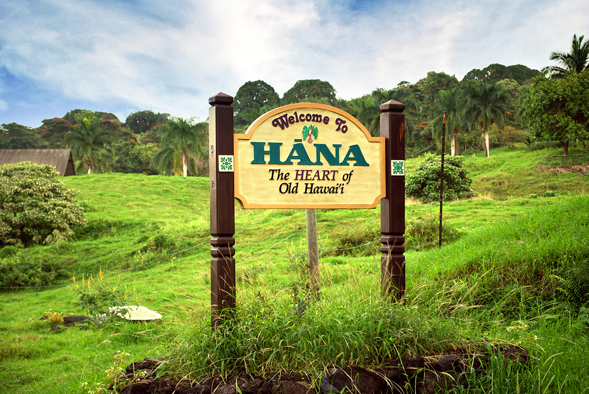
Visiting Maui's famous Road to Hana? This 64.4-mile stretch of highway is dotted with waterfalls, beaches, caves, hikes, and so much more. Visiting the Road to Hana is a once-in-a-lifetime experience that will leave you in awe of Maui's natural beauty.
Online gambling offers players the freedom and excitement of being able to play anywhere in the world, including the scenic routes of Maui. Many platforms with $15 deposit casino and immersive scenarios offer betting progression systems, where each game brings virtual rewards and bonus stages. Player statistics help track progress, adding to the excitement. Imagine enjoying the game while traveling along the Hana Road with Shaka Guide. Classic, Loop, or Reverse audio tours take you to waterfalls and beaches, and the casino delivers physical prizes – souvenirs or certificates – right to you. Shaka Guide provides travel convenience and the casino instant access to gamingcreating the perfect balance of relaxation and excitement.Key Takeaways:
- Shaka Guide offers detailed maps for three Road to Hana routes: Classic, Loop, and Reverse.
- Each map highlights major stops, points of interest, and alternate routes along the 64.4-mile Hana Highway.
- Planning ahead with these maps enhances the experience, helping travelers navigate the numerous attractions and scenic spots.
But, to make the most of your Road to Hana day trip, it's best to plan in advance. Check out our Road to Hana maps and start planning!
We have maps for three Road to Hana routes:
-
Classic
-
Loop
-
Reverse
About the Road to Hana Routes
Classic Road to Hana Route + Map
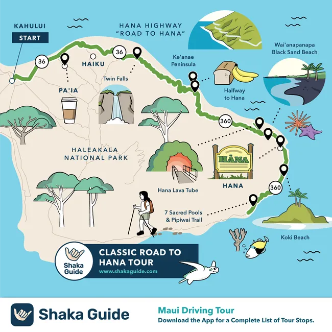
The "classic" Road to Hana route starts in Kahului near the airport and ends in Kipahulu, just outside Hana town. It takes about 10-12 hours to complete, and you can make over 20 stops on your way to Haleakala National Park!
Once you reach the park, you'll turn around the same way you came and head back to Kahului on Hana Highway. Check out the classic Road to Hana map below:

RELATED: Classic Road to Hana Itinerary
Loop Road to Hana Route + Map
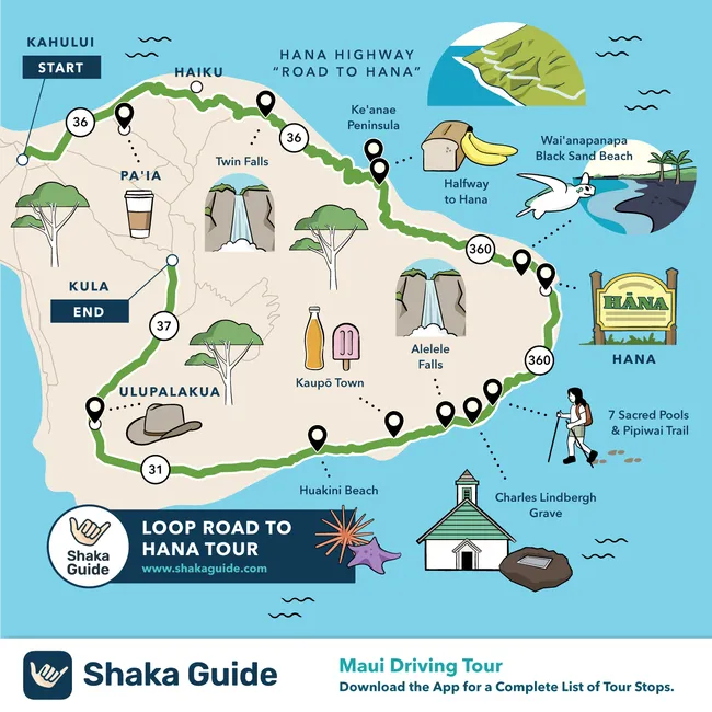
The Road to Hana "Loop" is an alternate way to complete the Road to Hana. This trip starts in Kahului like the classic, but instead of turning around in Kipahulu, you'll continue along the back road to Hana to the town of Kula in upcountry Maui.
From there, Kula is about 25 minutes back to Kahului. Check out the loop Road to Hana map below:
Online hazardní hry Plinko  otevírají českým hráčům svět vzrušení, kde osobní avatary a příběhy vytvářejí jedinečný herní zážitek. Dynamické multiplikátory zvyšují výhry a odměny za dosažené úspěchy a sezónní mise přispívají k nabití. Interaktivní chaty vám umožňují komunikovat s hráči z celého světa, zatímco si užíváte hru a cestujete po Hana Road s průvodcem Shaka Guide. Audio prohlídky na klasických, okružních nebo reverzních trasách vedou k vodopádům, plážím a parkům Maui a kasino https://nl-betcity.com/ zasílá fyzické ceny - od suvenýrů až po bonusové certifikáty. Průvodce Shaka Guide poskytuje pohodlí cestování s přesnými mapami a online Slovenské Casino Pro České Gráče vám dává svobodu hrát kdykoli. Tato kombinace cestování a vzrušení činí každou minutu nezapomenutelnou a umožňuje vám ponořit se do krásy Maui a zároveň do vzrušení ze hry. Užijte si svobodu pohybu a vzrušení a získejte ceny doručené přímo k vám.
RELATED: Loop Road to Hana Itinerary
Reverse Road to Hana Route + Map
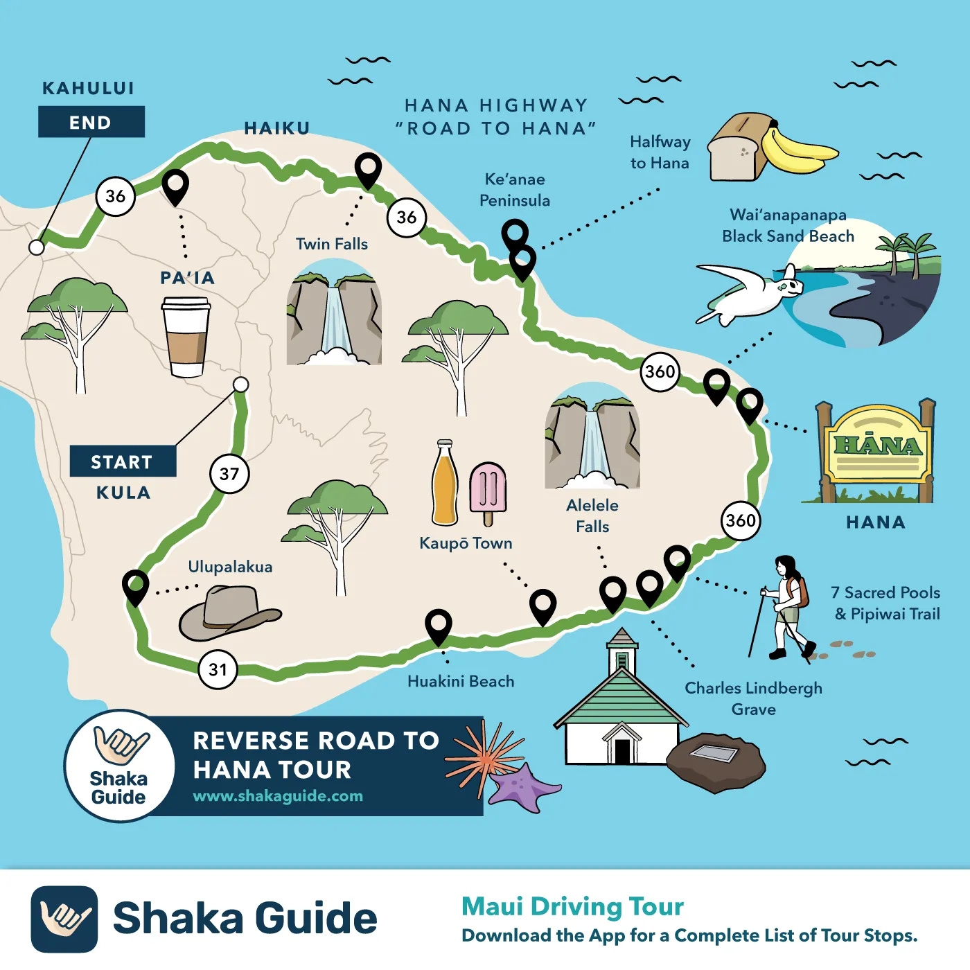
The "reverse" Road to Hana route is the exact opposite of the loop! If you take this trip, you'll truly be visiting the Road to Hana in a completely unique way.
You'll start in Kula, then work your way to Kahului, starting the Road to Hana at the end.
This drive truly has some advantages - like you'll visit some of the most popular stops (Waianapanapa State Park and Seven Sacred Pools) first!
You'll also be traveling in the opposite direction of traffic. Check out the reverse Road to Hana map below:
RELATED: Reverse Road to Hana Itinerary
Please note that if you're taking the loop or reverse routes, you'll be traveling on unpaved roads. Many rental car companies do not allow you to drive on the back road to Hana so you will be doing so at your own discretion.

Road to Hana Maps with Mile Markers

Check out our Road to Hana Map with Mile Markers to see where some of the must-see stops are along the road! This will give you an idea of how far you'll be driving before you reach that scenic lookout, a stunning waterfall, or that must-visit banana bread stand. Want to download this map? Subscribe Now!
How to Make the Most of Your Road to Hana Road Trip
-
Regardless of which route you choose, leave early. The Road to Hana takes about 10-12 hours to complete with stops.
-
Pay attention to sunset times if you don't want to be driving in the dark. We highly recommend you head back with enough daylight.
-
Be mindful of locals who drive the road every day. Please pull over to let local drivers pass and NEVER park illegally.
-
Be respectful by picking up your trash, staying on trails, and never disrupting plants or animals!
-
Embrace the journey! If you don't get to everything you planned, that's ok - this drive is a scenic trip with awe-inspiring beauty!
Like this article? Share it on Pinterest!


Planning a trip to Hawaii?
Explore the islands with Shaka Guide’s Hawaii Tour Collection — featuring self-guided tours for Oahu, Maui, Kauai, and Big Island.
Each tour includes turn-by-turn directions, local stories, and the freedom to explore at your own pace.
Still in planning mode?
Check out our Hawaii Guides and Itineraries for tips and trip ideas.
Have questions?
We’re happy to help — email us at aloha@shakaguide.com.
Visiting Maui? Download our Maui map packet!
RELATED ARTICLES:
Is The Road To Hana Dangerous?
Which Shaka Guide Road to Hana Tour is Right for You?
Road To Hana: Guide To Having An Epic Driving Tour
The Scenic Hawaiian Roller Coaster: The Road to Hana


 to fuel your ride
