


Hiking into the Grand Canyon South Rim

*All inner canyon trails and campgrounds, including North/South Kaibab, Bright Angel (below Havasupai Gardens), and Phantom Ranch, are closed due to chlorine gas from the Dragon Bravo Wildfire.*

Ready to Go Below the Rim?
Well, first of, all...congratulations. You'll see what few are priveleged to see, tread where few dare to tread. They say to fully appreciate the majesty of the Grand Canyon, you have to hike inside it.
Most hikers will set up camp at its base, but a few intrepid spirits will only have one precious day to attempt their down-and-up canyon hike. If touching that canyon floor is on your Grand Canyon bucket list, we’ll tell you exactly how to make it happen, all in one day. All it takes is a little planning.
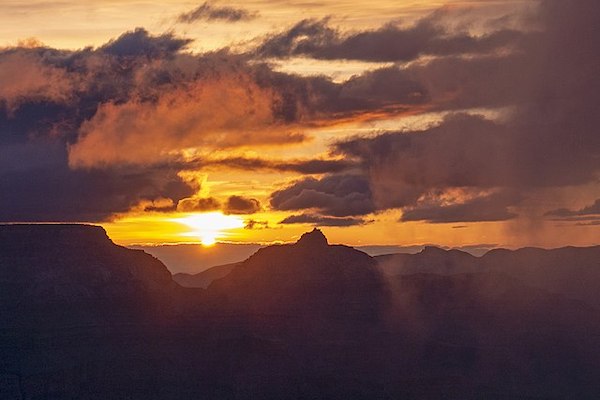
Choose a Trail
 Image from Shutterstock
First and foremost, you must decide whether to follow either Bright Angel Trail or South Kaibab Trail. Following either, you can hike all the way down into the canyon, take that selfie by the Colorado River, and be back up the rim without ever setting up camp. But with limited time to spare, which of these two famous trails is right for you?
Here’s a quick breakdown on the differences in South Kaibab vs Bright Angel Trail. For a more detailed look, keep reading below.
Bright Angel Trail
Trail Highlights:
- Less Steep/Less Strenuous
- Longer/LessDirect
- Water Refilling Stations Available
- Two Restroom Stops
- More-Crowded
- Still Great Views
- Parking Available Near Trailhead
South Kaibab Trail
Trail Highlights:
- More Steep/More Strenuous
- Shorter/Most Direct
- No Water Refilling Stations
- One Restroom Stop
- Less-Crowded
- Considered Best Views
- No Parking Near Trailhead (Must Catch Shuttle)
Bright Angel Trail
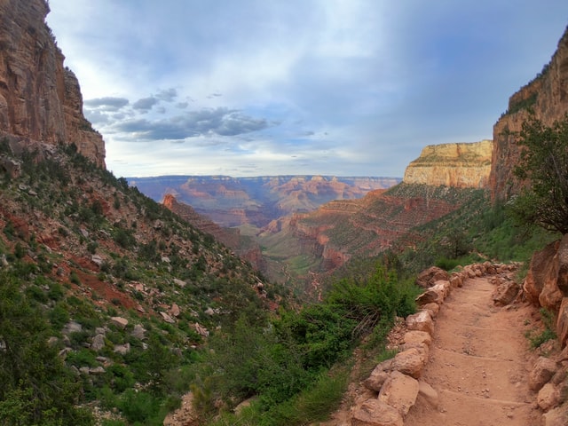 Bright Angel Trail / Image from Unsplash
- 15.6 miles (roundtrip), 4,478 elevation loss/gain, 10-13 hours (roundtrip)
- Difficulty: Strenuous, depending on distance
This trail starts between Bright Angel Lodge and Kolb Studio in Grand Canyon Village. There is parking right by the trailhead, but as with most spots on the South Rim, they fill up fast. If full, look for an available space along Village Loop Drive.
Bright Angel Trail is the most popular trail on the South Rim of the Grand Canyon, and for good reason. Along with its convenient starting point, this trail is well-maintained and is considered by many to be a great introduction to inner-canyon hikes, with 4-foot wide paths and an average slope of only 10 percent. Don’t let that fool you, though! This hike is still a strenuous 15.6-mile round-trip.
For hikers who don’t have time to explore its entirety, there are several excellent stopping and turnaround points along the way.
If you wish to hike down into the canyon taking Bright Angel Trail but return via South Kaibab Trail, continue past the Bright Angel Bridge and Phantom Ranch. The River Trail connects with South Kaibab over by Black Bridge.
Want to hear a Shaka-secret? About 10 minutes down from the trailhead, you’ll pass through the first dynamite-blasted tunnel. From there, high on the wall on your left, you can spot ancient pictographs. Further along the trail, you may be able to spot fossilized trackways on the rocks and boulders nearby. Keep on the lookout!
We’ll tell you all about the pictographs and more on our Grand Canyon South Rim Tour.
Note from the writer: This is one of my absolute favorite hikes at the canyon. Even if you don't have time to finish the hike, I highly suggest hopping on and hesading down for at least a mile or two. Just be sure to bring those walking sticks—your knees will thank you!
Bright Angel Trail Points of Interest
- 1.5 Mile Resthouse (3 miles, 2-4 hours roundtrip): At about 1,100 feet below the rim, this is a perfect turn-around spot for day hikers. Here, you can make use of the restrooms and water refilling stations before either heading back or continuing down the trail.
- 3-Mile Resthouse (6 miles, 4-6 hours roundtrip): Another 1,000 feet below the first resthouse. Replenish your water and use the restroom before continuing on.
- Indian Garden (9 miles, 6-9 hours roundtrip): 1,000 feet down from 3-Mile Resthouse. There is a ranger station with a small lending library at this campground, as well as picnic tables, a cool, shaded creek, and pit toilets.
- Plateau Point (12 miles, 9-12 hours roundtrip): To reach this scenic plateau overlooking the Colorado River, take the left fork onto Plateau Point Trail at Indian Garden Campground. Be advised that this is the furthest point recommended for day-hikers and all camping in Grand Canyon requires a wilderness permit.
- Garden Creek Waterfall (13.5 miles, 9-13 hours roundtrip): For those hoping to do a little canyoneering or snap a few instagram-worthy waterfall pictures, head right at the fork of Indian Garden Campground. This continues towards Garden Creek Waterfall and the River Trail.
- Bright Angel Bridge/River Trail Start (15.6 miles, 10-14 hours roundtrip-): 1,200 feet down from Indian Garden. If you want to touch your toes in the river, you’ll need to follow the trail down to Bright Angel Bridge. After nearly 8 miles,you’ll see a silver suspension bridge hanging over the roaring Colorado rapids below.
South Kaibab Trail
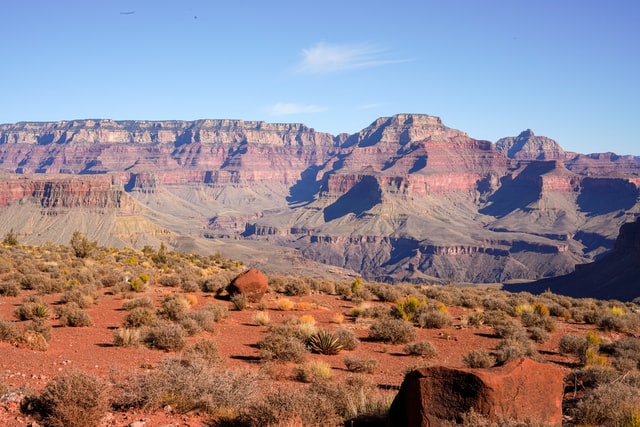 View of the O'Niell Butte from the South Kaibab Trail / Image deom Unsplash
- 13 miles (roundtrip), 4,872 elevation loss/gain, 10-14 hours (roundtrip)
- Difficulty: Strenuous, depending on distance
The South Kaibab Trail begins at Yaki Point Road, off of Desert View Drive. Because the trail is so popular, there is no parking at the trailhead. Start your adventure by parking your car at Grand Canyon View Information Plaza, over by Mather Point, and riding the Kaibab (orange) Shuttle. Alternatively, you can park in Grand Canyon Village and catch the Hiker’s Express Shuttle.
This hike is the quickest way to the Colorado River and Phantom Ranch, but it is also the steepest. This route, like the Bright Angel Trail, is broad and well-kept. A journey to and from the riverbank entails 13.8 miles of severe switchbacks with an average gradient of over 13%. There are numerous fantastic possible turn-around points.
The National Park Service created the toll-free South Kaibab Trail in response to Ralph Cameron's refusal to give up Bright Angel Trail. Although it started off as a detour around the Bright Angel toll station, today it is considered one of the most scenic hikes in the park. And another plus? South Kaibab Trail isn't as well-known as Bright Angel, so it is usually less crowded.
Be aware that aside from the trailhead, there are no water-refilling stations on this trail.
South Kaibab Trail Points of Interest:
- Ooh Aah Point (1.8 miles, 2-4 hours roundtrip): At just 800 feet down in elevation from the trailhead, this is a great short-day hike for some, and fantastic first viewpoint for others. Prepare to “ooh” and “aah” if you take in your first wide, unobstructed canyon views.
- Cedar Ridge (3 miles, 3-5 hours roundtrip): Wind your way down the switchbacks, losing another 1,100 feet in elevation before encountering Cedar Ridge. Named for the shady Cedar trees dotting the ridge, this is a great place to take a breather and a restroom break before heading back up or further down.
- Skeleton Point (6 miles, 7-10 hours roundtrip): Go down another 1,100 feet and three miles, and you’ll find Skeleton Point and one of your first chances to glimpse the Colorado River. If you are day-hiking, this is the furthest point recommended to hike to. Remember, all overnight camping trips require a wilderness permit.
- The Tipoff/Tonto Trail Junction (8.4 miles, 8-12 hours roundtrip): This is the last point before reaching the Colorado River, and the junction to the epic Tonto Trail.
- Black Bridge/Kaibab Bridge (13 miles, 10-14 hours roundtrip): For those unstoppable explorers who make it this far, they’ll finally be rewarded with an up close and personal view of the Colorado River. Walk across the suspension bridge before either heading back to join the River Trail or continuing to the North Kaibab Trail.
Tips for Hiking Down and Up in One Day
If you want to make sure your one-day rim to floor hike is as safe and enjoyable as possible, plan to return before or shortly after dusk. We suggest you head out no later than 7 A.M. Expect this adventure to take anywhere from 10-14 hours, depending on stops and physical fitness.
Don’t get overconfident after you reach the bottom! However long it takes you to get down, assume it will take nearly twice that long to get back up.
One way to jump-start your hike is to catch the “Hikers Express Shuttle.” You can find this shuttle over by Bright Angel Lodge. This shuttle stops at the Backcountry Information Center, the Visitor Center terminal, and then the South Kaibab Trailhead.
This shuttle departs on the hour, beginning as early as 5 A.M, depending on the season. Check the shuttle schedule here. Get there early if you want to be one of the first to board, as the shuttle can fill up quickly.
Grand Canyon Rim to Canyon Floor: What to Expect
Along with new perspectives and stunning views, hikers descending to the canyon floor will also encounter changes in temperature, climate, and wind. Even though it might be cool and breezy up at the top of the canyon, the temperature will increase as the elevation drops, and most of the wind will be blocked by the canyon walls. Dress in layers that you can remove easily as you descend to stay comfortable. At the bottom of the canyon, the temperatures regularly exceed 100 degrees fahrenheit (38 celsius) in the summer. No matter the season, expect the canyon floor to be around 20°F hotter than at the top.
No matter which trail you choose for your day hike, the right equipment can make all of the difference. In the shaded inner canyon walls, snow and ice can cling on for weeks after the sun has melted it on the rest of the canyon. Be prepared with high-traction shoes or crampons if you’re hiking in early spring. And don’t forget, both South Kaibab and Bright Angel Trail are pretty steep, so be sure to have your walking sticks with you.
One last piece of advice? A one-day down and up hike is strongly discouraged during the summer months. Many people underestimate the canyon’s soaring temperatures and steep elevation. Remember, the way down will be cool and easy in the morning, but the way back up will be hot and strenuous. From early summer to early fall, heat exhaustion is a very real concern in the Grand Canyon.
About the Writer:
Rachel Ennis is a storyteller, nature nerd, and park enthusiast who believes every trail has a tale. When she first visited the Grand Canyon, she fell in love—with the layers, the legends, and the way nature can heal the spirit. Now, she’s on a mission to share the stories that live in the land—and the places that make us feel small in the best way.
Looking for shorter day hikes? Check out our list of the Top Grand Canyon South Rim Hikes.
RELATED ARTICLES:
The Ultimate Grand Canyon South Rim Travel Guide
Grand Canyon, North vs South Rim: Everything You Need to Know
The Best Views Grand Canyon South Rim
20 Things to Do at the Grand Canyon South Rim
Know Before You Go, Shaka Guide’s Grand Canyon South Rim Tour
Shaka Guide’s Grand Canyon South Rim Tour Itinerary